It's been around for a year or so in Vic. The SA version looks to be in km/hr for wind. The Vic version is in knots.
It's a forecast for 6 km square blocks and if you click any where on the water you get a table of wind speeds forecast for the day for that particular 6 x 6 km block on the map. By far the most useful wind forecast map available and I have found it to be a lot more acccurate than anything else. It's so good it forecasts when the sea breeze arrives at my spots as it progresses up the bay.
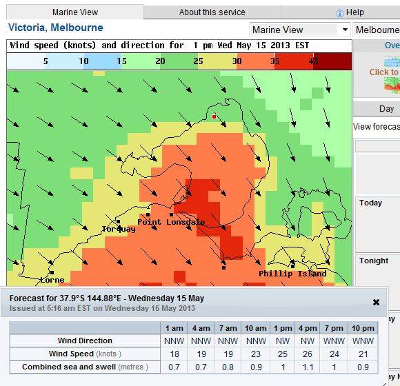
The forecast table is for the red spot where I clicked on the map