Manly cove to pittwater.

> 10 years ago
Reply
Register to post, see what you've read, and subscribe to topics.
Hucklbuck
Hucklbuck
1 posts
1 posts
30 Jan 2013 8:58pm
Newbie , Hi all ,
I have never raised a sail , there seems to be a wealth of knowledge here so i hope you don,t mind a few(hundred) questions ,

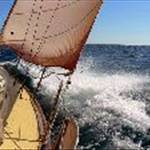
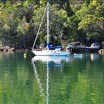
Seems i may have a Bluebird 22 , the de-lima is i don,t no how to sail it ,its in sydney and im on the central coast , my question is what would be a ball park figure time wise to sail from manly cove to say ettalong , i realise prevailing weather is the key to sailing ect , bit of a how long is a piece of string thing.
It would probly take 5-6 hours on the motor i supose .

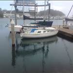
The boat is fitted with a well for the outboard , does this setup work ok in a swell or is it only good for fairly flat water? (cavitation ect)

Whats the best weather site to use ?

Idea is to play with it for a few weekends , then run to manly cove camp the night, and if the conditions are right motor on the morning glass till a breeze picks up .
I will stow a spare outboard just to be safe.

Sound like a plan?

MichaelR
MichaelR
NSW
862 posts
NSW, 862 posts
31 Jan 2013 1:40am
Hucklbuck, it does sound like a plan. However you will need to choose your wind and swell carefully.

If you're travelling in open water there are some safety items you must carry to be legal, and safe. These can be found on the Roads and Maritime website.

The distance is about 20 nautical miles, your Bluebird would average 4 to 5 knots in perfect conditions, so you're looking at roughly 5 hours. If the wind is anywhere in the North to Northeast It will take you longer.

If you've never raised a sail before, it may pay you to take an experienced sailor with. Because a Bluebird is not really a boat for outside, although on a reasonable day you'll be fine.

How long since the boat has been moved? Are the sails in good condition? What about the sheets and rigging? Is the bottom of the boat clean, or covered in barnacles? If its not clean you will take forever to get there.

Hope this is of help, PM of you want details.
Have you got your mooring arranged for Ettalong?

The engine should be fine in the well if it's a long shaft, although a short shaft will also be ok in a light swell.
keithw
keithw
NSW
190 posts
NSW, 190 posts
31 Jan 2013 10:38am
Hucklbuck,

there is a passage planner in one of the many disscussion on the forum and I couldn't find the one so I can email it to you if you want. The pkanner was posted on the forum a while ago and I hope I'm not breaking any rules but it may help you setup your passage plan.
Keith
Charriot
Charriot
QLD
880 posts
QLD, 880 posts
31 Jan 2013 11:25am
I did similar crossing with similar boat.
1/get the boat ready- go over and check obvious stuff, loose, leaks, pump /if any/
safety gear, chart, GPS, ropes, /only rope is on the bell/ , rubbish
in petrol tank, just common sense.
2/get ready for sailing window / I pick mine too carefully, was no wind at all and motoring all day/
but with 4 stroke just use one tank/

3/have fun along the way, outboard hanging from transom, has no problem with swell
but works like vacuum cleaner , picks up plastic bag, sea grass, floating ropes atc.
HaveFun
HaveFun
NSW
201 posts
NSW, 201 posts
31 Jan 2013 2:32pm
Can someone explain why in the passage planner The track Port Hacking to Broken Bay is listed as 33.9nm and the reverse track from Boroken Bay to Port Hacking is given as 27nm. I note the Port Hacking to Port Jackson is given as 17nm and Port Jackson to Broken Bay is 18nm which would make the distance Port Hacking to Broken bay more like 35nm. Is the passage planner taking into account distance variations for departure or arrival tracks shown on the charts? I note Botany Bay is not mentioned.
LooseChange
LooseChange
NSW
2140 posts
NSW, 2140 posts
31 Jan 2013 2:44pm
HaveFun said...
Can someone explain why in the passage planner The track Port Hacking to Broken Bay is listed as 33.9nm and the reverse track from Boroken Bay to Port Hacking is given as 27nm. I note the Port Hacking to Port Jackson is given as 17nm and Port Jackson to Broken Bay is 18nm which would make the distance Port Hacking to Broken bay more like 35nm. Is the passage planner taking into account distance variations for departure or arrival tracks shown on the charts? I note Botany Bay is not mentioned.


It could be just an up-hill / down-hill kind of anomaly , you know, with the current or against the current.
BlueMoon
BlueMoon
866 posts
866 posts
31 Jan 2013 3:05pm
You'll need to sort the yacht out before thinking about any trips out in the ocean.

There are lots of experienced people who are willing to answer any questions about the yacht or preperation.
Getting to know the yacht first is a good idea, as is taking an experienced sailor.

Pt Jackson to Broken Bay is probably one of the easier passages on the east coast, & when conditions are right you wont be alone, there will be a procession of yachts doing the same trip, which is comforting (although their probably be bigger & faster!), you need to think of everything so you'd be better off going with a southerly, so i'd suggest overnighting first at Rose Bay(easy anchorage), rather than Manly.

Get your safety gear & processes right, that includes logging on with Marine Rescue.

I havent had much experience around Ettalong, do you have to get the tides right there?

cheers
HaveFun
HaveFun
NSW
201 posts
NSW, 201 posts
31 Jan 2013 9:36pm
Interesting idea Loose Change however the notes say:
"2]The distances shown are the shortest course over ground (COG) rhumline distances taken from a normal departure point to a normal arrival point clearing all hazards by a safe margin, in the case of a marina the marina entrance, in the case of a river, the river bar.
3) The distances shown do not take into account the quickest route dictated by tidal and other currents."
MorningBird
MorningBird
NSW
2711 posts
NSW, 2711 posts
31 Jan 2013 10:46pm
G'day Hucklbuck,

I've done this leg a few times. It can be a pleasant and scenic few hours sail, but it is open ocean and as we experienced last Friday forecasts aren't always predictable. You need the minimum offshore gear as described by others and bungs for each opening in the hull.

Sort the boat out to make sure you know where everything is and how everything works. Spend a few days onboard getting to know it. Plan to sail the trip with the motor as a backup, it will also be faster.

I may be able to give you a hand if you want soemone to go with you. I'd need to check the boat out before I would commit. Where is it moored now?

You won't have a problem getting into Ettalong, your draft will be fine up the channel into Brisbane Water.

Cheers

LooseChange
LooseChange
NSW
2140 posts
NSW, 2140 posts
1 Feb 2013 5:34am
HaveFun said...
Interesting idea Loose Change however the notes say:
"2]The distances shown are the shortest course over ground (COG) rhumline distances taken from a normal departure point to a normal arrival point clearing all hazards by a safe margin, in the case of a marina the marina entrance, in the case of a river, the river bar.
3) The distances shown do not take into account the quickest route dictated by tidal and other currents."


Ok, you didn't seem to like that idea all that much.
Try this one ....... Coriolis effect?
Charriot
Charriot
QLD
880 posts
QLD, 880 posts
1 Feb 2013 8:43am
Sorry Loose Change

Coriolis applies for planes only.
North - South and reversal directions.
LooseChange
LooseChange
NSW
2140 posts
NSW, 2140 posts
1 Feb 2013 2:26pm
Charriot said...
Sorry Loose Change

Coriolis applies for planes only.
North - South and reversal directions.


Dammit! ... you people are hard to please today.

Ok then, the only feasible thing left that it could be then is that the stars were not perfectly aligned.

P.S. Coriolis force also affects ocean currents
Please Register, or first...
Topics Subscribe Reply