SA
4805 posts
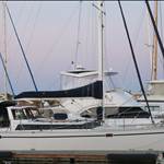
Ok so far I have used navitronics APP on my iPad just under 500nm heading from Airlie beach to lizard island without a glitch. Got all the paper charts out last week just for a peak but quickly rolled em with great difficulty back into the chart draw never to be seen again! Touch wood!
Anyone else having fun with iPad?
NSW
862 posts
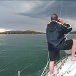
Yep, I have used it for about a year now. Navigated Pittwater to Lake Macquarie solo return, night/day and had no issues. Especially in the Swansea channel where it's narrow, the Navionics was really accurate.
Michael

VIC
605 posts
Yep, Navionics iPhone/iPad is certainly worthwhile. It proved it's worth as we found, entered and then picked our way through the shallow winding Port Albert channel all the way up to Corner Inlet one moonless night last year - check it out on the app and you'll see what I mean.
None of us had been there before and normally wouldn't have attempted it under the conditions, but needed to get a seriously seasick crewman on to terra firma.
I think you need the charts as a backup and preferably two independent electronic chart systems (say Navionics iPhone & iPad or 2 iPads, etc) to cover the failure of one.
Allan

WA
868 posts
Navionics on an iphone / ipad is a good reliable nav tool - It has been discussed elsehwere in this forum. Only caveat is that iphones & ipads are generally not that robust or weather resistant - Beware if you rely on them & are caught in unfavourable weather ;-) A proper "marinised" gps / plotter is nice to have!
Poods
VIC
605 posts
I agree Poodle. You can do a reasonable 'marinising' job on your iPhone/iPad simply by silpping it into one of the better ziplock bags. If you don't fully trust the ziplock seal fold the end of the bag over and seal it off with some duct tape or alternative.
The touch screen functionality still works fine.
Allan
NSW
862 posts
I bought a waterproof map satchel from Whitworths for au out $30. Drawback is the glare, but at least the iPad is safe, and will float too.
Michael

55 posts
I use Navionics on my Android smartphone and LOVE it. I took my 37ft Cat from Mooloolaba to Lady Musgrave last year using it, and it was fantastic. That includes the Great Sandy Straits at night (never been through them before) with no worries at all. Kept checking with charts, but it was never wrong.

QLD
363 posts
Just spent 3 months cruising Fiji...many reefs and small channels. I have used a few apps, including Navionics and compared against Maxsea, Open CPN while on route and it's is fairly good. However there where some small channels that without eyeballing, and use of the other software we would have grounded it, it was off by 30- 50 odd meters. The app that I have found very useful, is GPX HD Motion X. You can download and store the Bing images offline, and Google maps online to get a Birdseye view, great for night, as you see it like daytime. It's accuracy has been amazing, doesn't show depths, hence refer to other nav products. Very good product, and has lots of features that Navionics doesn't. The 2 together are the go... However what both are missing is good route planning...
If Open CPN ever does a IPad version, then all bases covered, just buy 2 iPads in case one ever fails, still cheaper than a chart plotter/ charts, and more realiable than pc's, and battery life is amazing.
To charge off 12v, make sure to get a high amperage USB converter, the standard ones for iPhones etc won't charge while using...I forget exact draw, however it needs something like 2-3 amps..( check apple forums)..iPhone and other converters are normally 0.5amp. Or charge from an inverter, and use normal 110/240 charger.