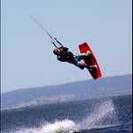
Does anyone know. The SB charts regularly (almost always) show any SWly type arrows stronger at Ocean Reef than anywhere south. Is this just wind meter locations or do you northies really get more of the pie? Frustrating when ur looking back at marginal days like yesterday.
where the readings are taken at ocean reef there is also a slight wind funnel effect, so usually (more so when the wind is lighter) reads a tad higher than what pinnas/mulz actually is.
swanny average reading is generally a tad lower than actual (with larger average to gust variation) as the wind at the station is dune effected or in a bit of a wind shadow.
To be honest I think default pretty much hit it on the head.
I think probably due to the coastline sticking out a bit further up North and copping it slightly more onshore we probably do get a bit more clear wind up this way. I also think that due to the position and height above sea level of the gauge the Ocean Reef graph shows little bit more than there actually is, and the likes of the Swanny and Mandurah ones show a little less than there actually is.