Seabreeze Tides: Built for Anglers

In short
Seabreeze now delivers graphical tide charts for coastal and inland waterway locations across Australia, with a location search and map finder built for anglers who need the right tide at the right spot.
The new tides page integrates directly with Seabreeze's existing wind and weather forecasts - the platform most Australian water users already rely on.
What this means for fishing
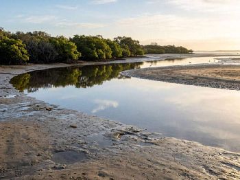
Find the exact tide for your estuary, river mouth, or boat ramp - not a generic forecast for the nearest major port.
For fishing, the tide matters more than almost any other condition - but getting accurate tide times for a specific estuary entrance, boat ramp, or upstream river section has always meant knowing the local secondary port correction and applying it manually.
Seabreeze's new tides page handles that automatically: search by location or tap the interactive map, and the system finds the nearest tide station and serves the corrected data for your spot.
The difference from a generic tide table is most obvious for inland and estuarine fishing spots, where tidal lag from the ocean entrance can shift the turn by 1-2 hours compared to the published port times.
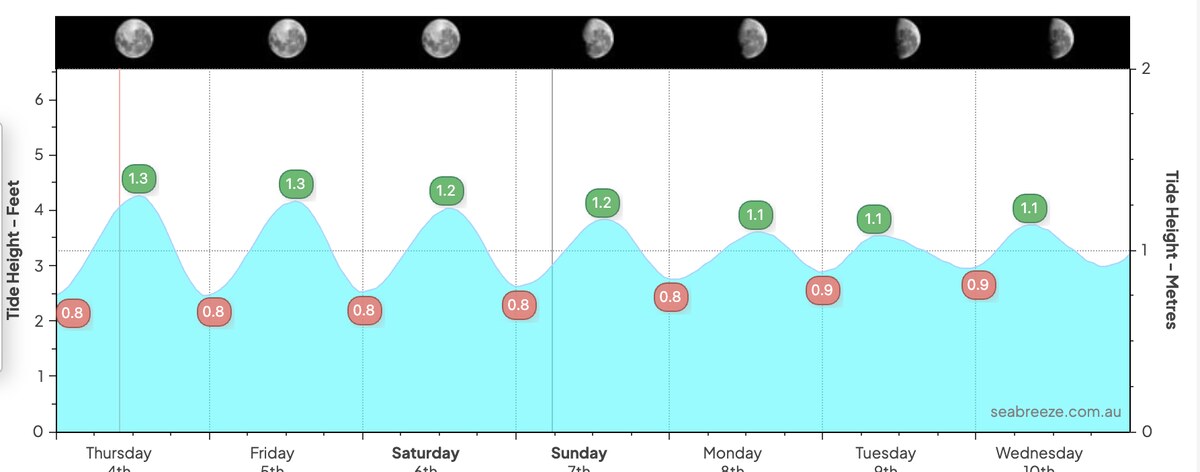
Graphical tide curves replace number tables, making it immediate to see whether you're heading into the run-in or run-out, how steep the change is, and where the peak high and low sit in relation to your planned session window.
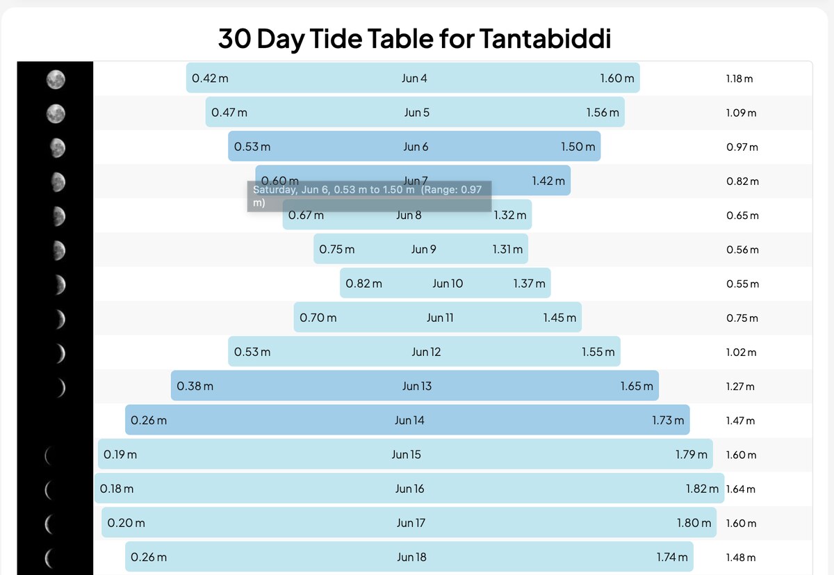
The 30-day tide overview is built for planning further ahead - useful for booking a charter, scheduling a trip to a distant reef, or timing a dawn session at a specific tidal phase without building a spreadsheet.
Wind and swell data are already the reason most Australian fishers use Seabreeze daily - tides being on the same platform means the full picture for session planning is now in one place.
Search your fishing spots at seabreeze.com.au/weather/tides .