Yacht Rescue -Elizabeth Reef

Two weeks ago
Reply
Register to post, see what you've read, and subscribe to topics.
EastCoastSail
EastCoastSail
383 posts
garymalmgren
garymalmgren
1436 posts
1436 posts
19 Sep 2026 5:50pm
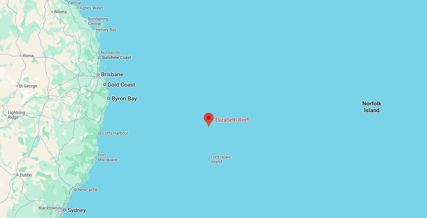
Is there an Elizabeth Reef in the Whitsundays?
I know of the one north of Lord Howe Island.

Madmouse
Madmouse
441 posts
441 posts
19 Sep 2026 6:02pm
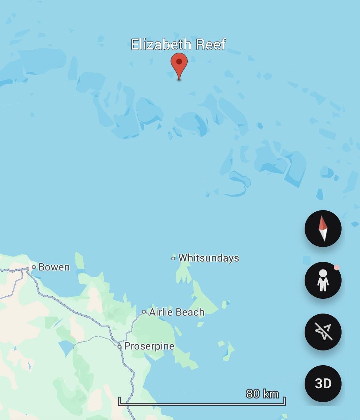
Yeah l looked it up..apparently out the back of the whitsundays
EastCoastSail
EastCoastSail
383 posts
383 posts
19 Sep 2026 7:37pm


Pretty challenging area to go sailing in.


shaggybaxter
shaggybaxter
QLD
2699 posts
QLD, 2699 posts
19 Sep 2026 10:08pm
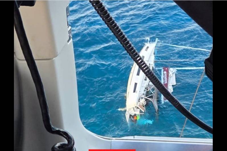
Talk about the nick of time, the boat turned turtle whilst they were effecting the rescue.
And only yesterday the Qld Government announced they were looking at a single provider from Mackay to Rockhamtpon.
Great effort by the CQ rescue team!
garymalmgren
garymalmgren
1436 posts
1436 posts
19 Sep 2026 8:43pm
Thanks East Coast .
And to think that Cook sailed through there with a non-operational chartplotter and a dicey GPS.

Gary
cisco
cisco
QLD
12370 posts
QLD, 12370 posts
20 Sep 2026 9:15am
It is actually Elizabeth Rock and Middleton Reef north of LHI. 😀
JonE
JonE
VIC
664 posts
VIC, 664 posts
20 Sep 2026 11:13am
garymalmgren said..
Thanks East Coast .
And to think that Cook sailed through there with a non-operational chartplotter and a dicey GPS.

Gary


True but he was one of the foremost navigators and chart makers of his day and he did have nearly 100 crew including guys 100 feet up in the air on lookout.

Toph
Toph
WA
1908 posts
WA, 1908 posts
20 Sep 2026 10:37am
And ran aground.
JonE
JonE
VIC
664 posts
VIC, 664 posts
20 Sep 2026 12:42pm
One wonders whether his famous diplomatic abilities hindered his ability to elicit local knowledge?
cammd
cammd
QLD
4596 posts
QLD, 4596 posts
20 Sep 2026 12:57pm


JonE said..


garymalmgren said..
Thanks East Coast .
And to think that Cook sailed through there with a non-operational chartplotter and a dicey GPS.

Gary


True but he was one of the foremost navigators and chart makers of his day and he did have nearly 100 crew including guys 100 feet up in the air on lookout.


The ship anchored or hove to at night and men were taking soundings with the lead line continuosly for over 360 leagues when they were inside the reef plus long boats out in front searching for a way through. They devised a signal system so the long boats could communicate with the ship instantly. The best bower was always ready to be dropped at a moments notice. I think the average speed was only 2 or 3 knots as they crept up the inside of the reef.

I just finished reading the book on him by Rob Mundle. Very Interesting.



MorningBird
MorningBird
NSW
2717 posts
NSW, 2717 posts
20 Sep 2026 7:26pm
cisco said..
It is actually Elizabeth Rock and Middleton Reef north of LHI. 😀


No mate. It is Elizabeth Reef. I thought of going up there on a Lord Howe run but the anchorage loos very iffy.
australianmarineparks.gov.au/static/6ecf5cc80f1292820defeeb533603f0f/16389-elizabethmiddletonreef.pdf
cisco
cisco
QLD
12370 posts
QLD, 12370 posts
21 Sep 2026 10:03am
I stand corrected. 😀
garymalmgren
garymalmgren
1436 posts
1436 posts
21 Sep 2026 8:26am
Not to harp on, but very interesting history.
en.wikipedia.org/wiki/Elizabeth_Reef
garymalmgren
garymalmgren
1436 posts
1436 posts
22 Sep 2026 11:00am
The view from the chopper window.

cammd
cammd
QLD
4596 posts
QLD, 4596 posts
22 Sep 2026 1:18pm
EastCoastSail said..


Pretty challenging area to go sailing in.


I think this is where it ran aground, approx 120miles North of Mackay, 120 miles east of Townsville
,
saltiest1
saltiest1
NSW
2583 posts
NSW, 2583 posts
22 Sep 2026 2:04pm
So fair to assume the keel was lost after running aground. What make is the yacht?
JonE
JonE
VIC
664 posts
VIC, 664 posts
22 Sep 2026 2:13pm
precise coordinates in this video www.facebook.com/reel/1589256169334073
Quixotic
Quixotic
ACT
254 posts
ACT, 254 posts
22 Sep 2026 5:11pm
If the LatLong on the AMSA video is about right, then it happened ~179NM West (271) of south end of Marion Reef/Paget Cay, about 51NM North (009) of Hook Island in the Whitsundays and 94NM East (086) of Cape Bowling Green.


shaggybaxter
shaggybaxter
QLD
2699 posts
QLD, 2699 posts
22 Sep 2026 5:33pm
saltiest1 said..
So fair to assume the keel was lost after running aground. What make is the yacht?


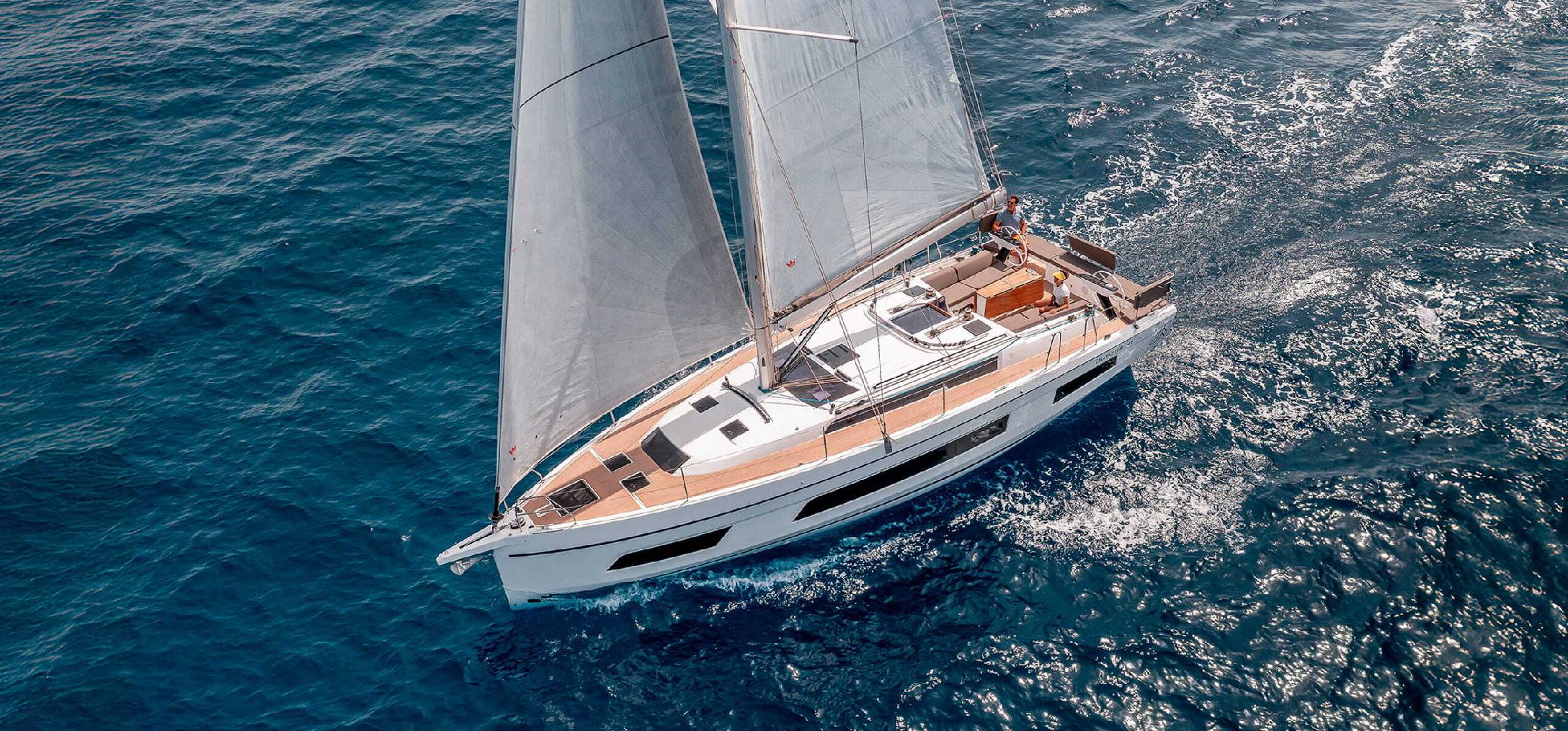
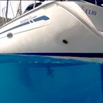
Looks a lot like a Dufour 41.


SeanTsv
SeanTsv
QLD
30 posts
QLD, 30 posts
22 Sep 2026 7:07pm
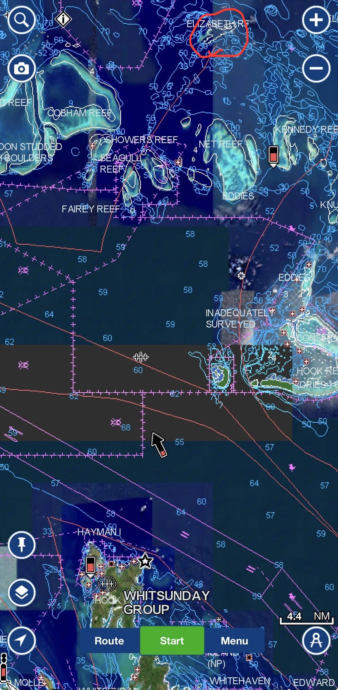
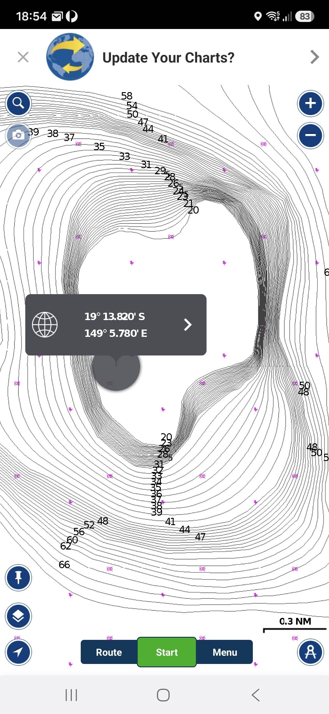
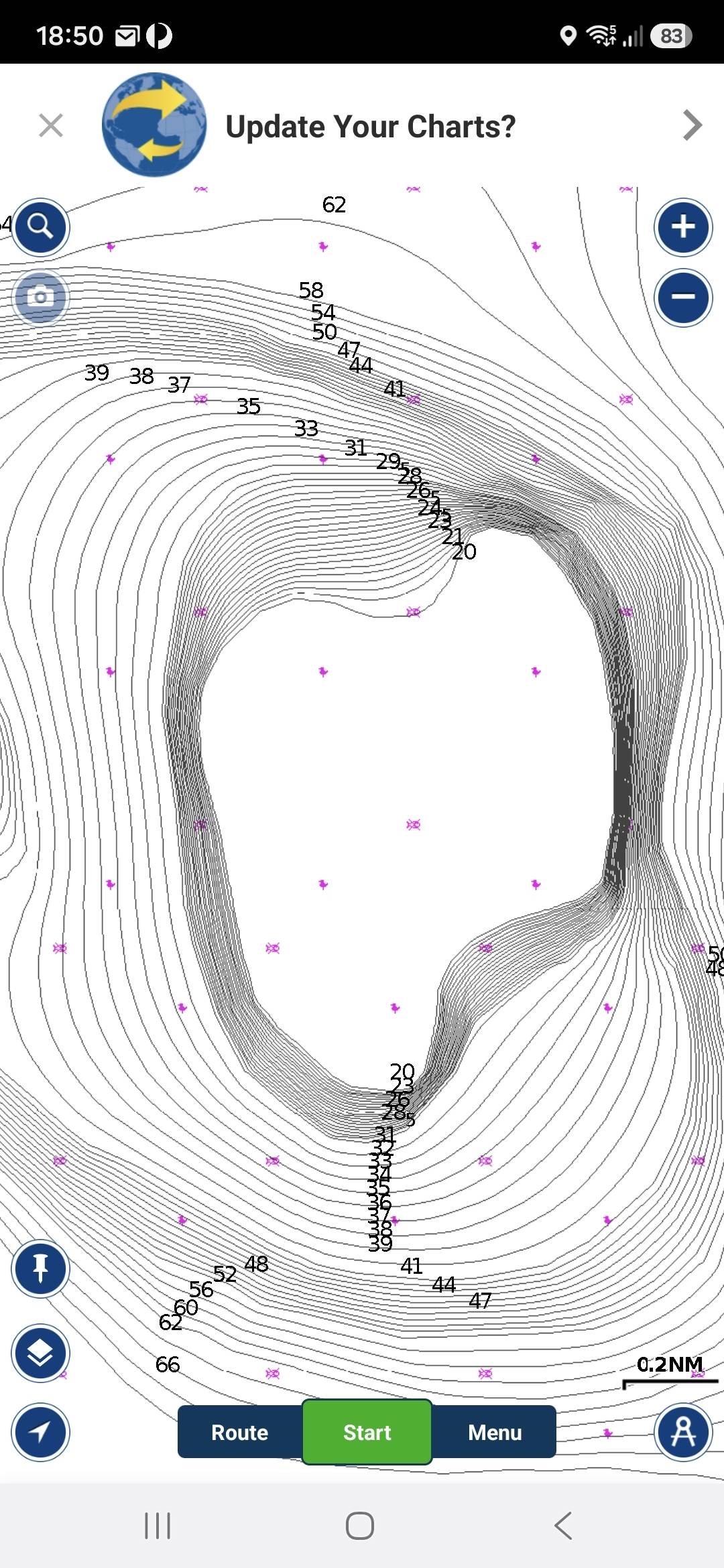
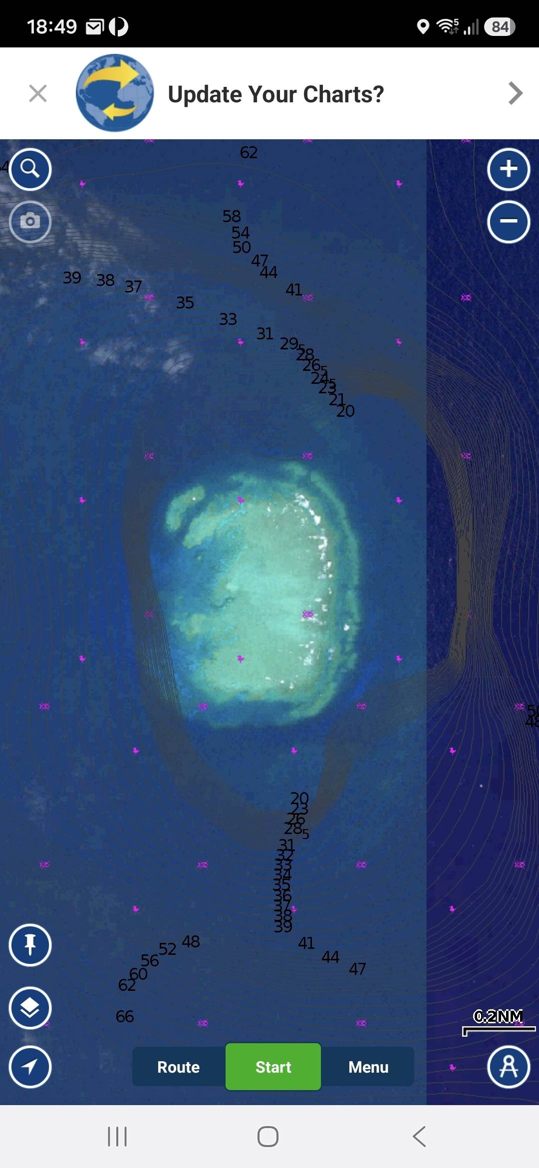
Attached some screenshots from Navionics. Lat and Long from target on AMSA video. It shows clear water at 20 metres deep. When I Map Options, Overlay Satellite Imagery there is obviously a reef there.
Sean


Quixotic
Quixotic
ACT
254 posts
ACT, 254 posts
23 Sep 2026 11:23am
That is not reassuring in respect of Navionics (Garmin) chart.
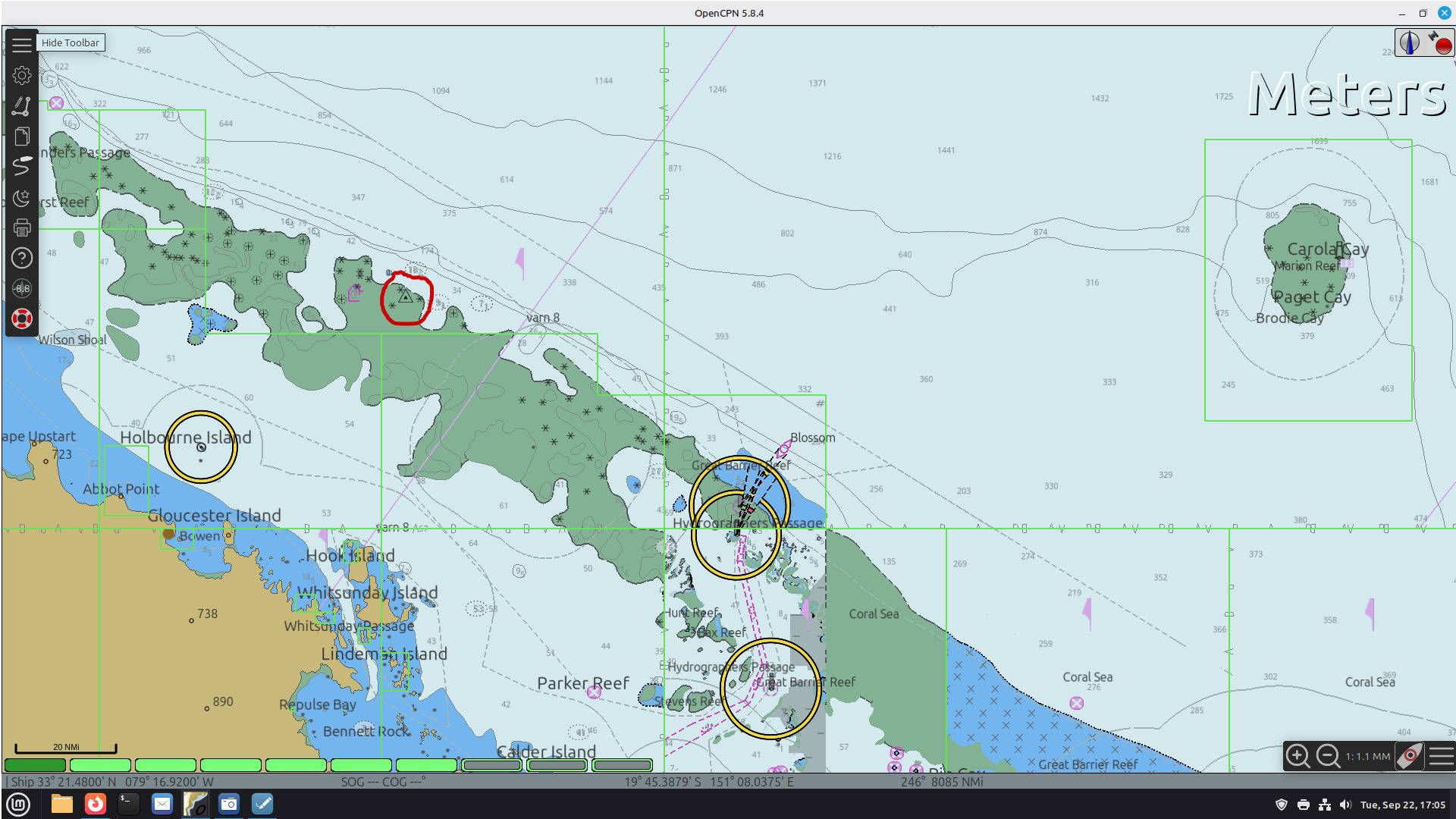
The location (the triangle around a dot within the red circle) that I plotted on OpenCPN is at 19° 13.406' S 149° 05.050' E and shows it in area that is not always submerged. Certainly doesn't have a least depth contour of 20m(!)
Bringing up the summary chart notes on that location yields: "Obstruction (OBSTRN); foul area(6); shoaler than range of depth of the surrounding depth area; depth unknown(2); WATLEV covers and uncovers(4)"


garymalmgren
garymalmgren
1436 posts
1436 posts
23 Sep 2026 10:53am
Hi Qix
I just checked your open CPN chart.
What is a small triangle within a larger triangle on a chart?
Is it generic or specific to Open CPN?
I can't recall seeing it before.
Gary
Quixotic
Quixotic
ACT
254 posts
ACT, 254 posts
23 Sep 2026 2:44pm
Hi Gary.
Hope you’re not affected by Typhoon Dujuan.

Short answer is it’s a waypoint.

In OpenCPN I stuck a waypoint at the lat long to mark the location. As it is hard to see, I drew a red circle around it on the screenshot I posted (see
my first post in this thread). It shows the location as being in an area which is very shallow - see chart notes for location quoted in my second post.
garymalmgren
garymalmgren
1436 posts
1436 posts
23 Sep 2026 1:38pm


Thanks for the explanation, Quix.
Not such a god place to drop a waypoint marker though. 😆

Re; Hope you’re not affected by Typhoon Dujuan.
Lot's of rain.
No problems at my place, Up nice and high, but it is a real shame to see the state of the rice paddies.
They were to be harvested this week.

gary
Chris 249
Chris 249
NSW
3610 posts
NSW, 3610 posts
23 Sep 2026 7:41pm
Does anyone have a paper chart of the area?

Maybe I’m just an old fart, but there seem to be so many problems with electronic charts that using the paper chart as backup seems to be the only way to go.

SeanTsv
SeanTsv
QLD
30 posts
QLD, 30 posts
23 Sep 2026 9:01pm
The owner of the yacht that sank reported that their paper charts had the reef but the electronic charts didn't.
www.mackayandwhitsundaylife.com/article/family-marooned-after-yacht-strikes-reef
Not sure if that link is on a pay wall but the main part is copied below.
I have paper charts of The Withsundays but it only goes as far East as Cobham Reef which is about 7nm from the reef in question, which is off the page.


Planter
Planter
NSW
193 posts
NSW, 193 posts
24 Sep 2026 5:35am
Back to before Cook !
saltiest1
saltiest1
NSW
2583 posts
NSW, 2583 posts
24 Sep 2026 7:11am
SeanTsv said..
The owner of the yacht that sank reported that their paper charts had the reef but the electronic charts didn't.
www.mackayandwhitsundaylife.com/article/family-marooned-after-yacht-strikes-reef
Not sure if that link is on a pay wall but the main part is copied below.
I have paper charts of The Withsundays but it only goes as far East as Cobham Reef which is about 7nm from the reef in question, which is off the page.


Here I am thinking it’s normal to cross reference a course on paper charts prior to departure.
garymalmgren
garymalmgren
1436 posts
1436 posts
24 Sep 2026 6:05am
RE: I have paper charts of The Withsundays but it only goes as far East as Cobham Reef which is about 7nm from the reef in question, which is off the page.

There lies the rub.
Which charts and at what scale do you need to safely navigate the G.B.R?
The correct answer is, Every chart at every scale.
How realistic is that?

Gary
JonE
JonE
VIC
664 posts
VIC, 664 posts
24 Sep 2026 8:57am
OK this seems important.

Navionics doesn't seem to have the rock.

Can anyone say whether the charts based on the aus hydro encs have the rock?


Please Register, or first...
Topics Subscribe Reply