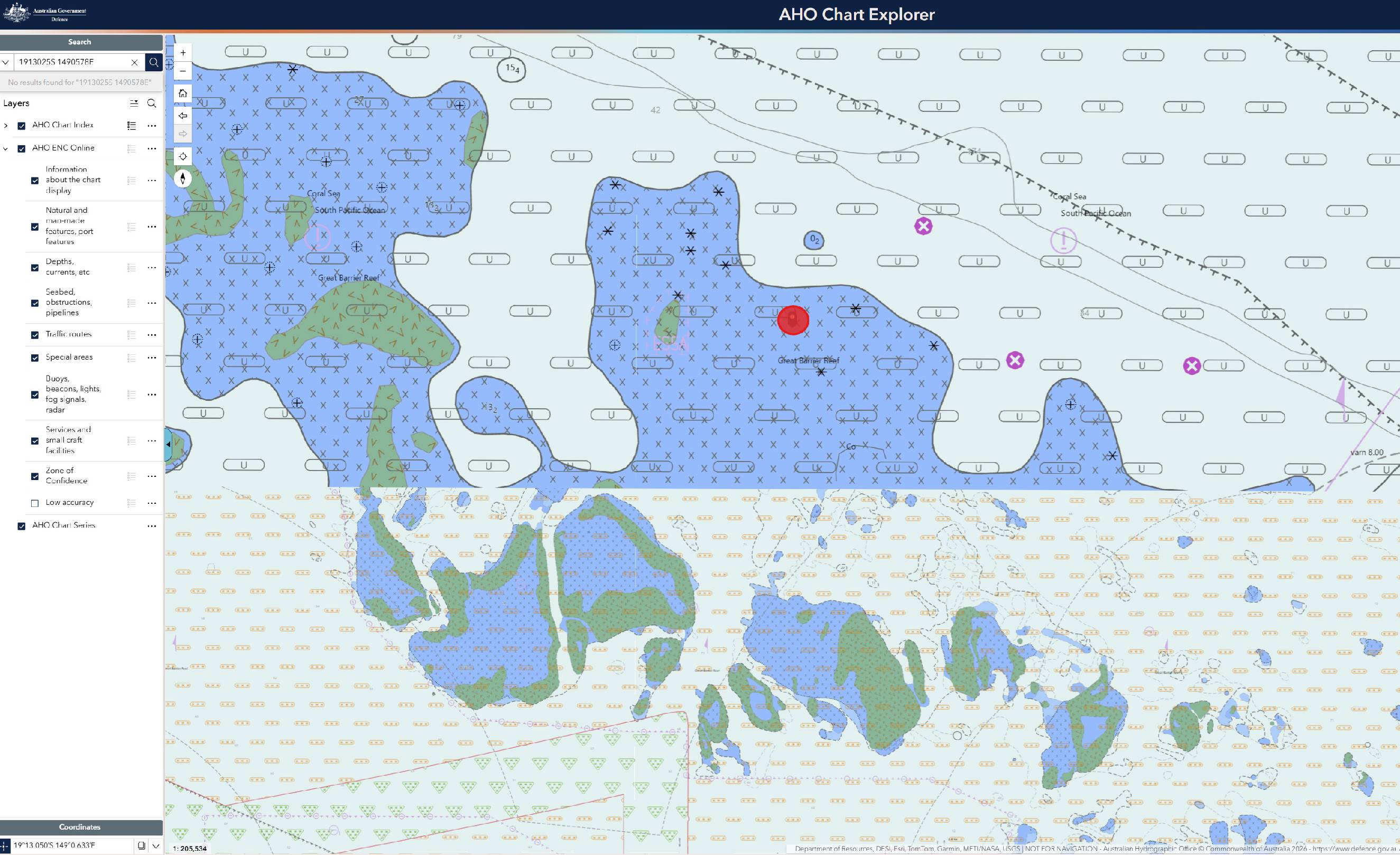
This is a screenshot from the Australian Hydrographic Office.
You can see the detail in the bottom half, that's the AUS 825 paper chart, it finishes 7 odd nm south of their position.
The top half is ENC 320149. You can see the change in accuracy.
What is telling is the Zone of Confidence, a grading that tells you how trustworthy the information is.
6 stars is A1. This is the best grading, 5mtr position accuracy and 0.5m in depth.
3 stars is C (bottom half of pic). This is an average grading, defined as +/-500mtr position and 2mtr in depth.
U is unassesed. Eg: WARNING WARNING. In some cases, U can refer to nineteenth century lead-line work, or satellite/aerial imagery. The depth can be out by 10's of mtrs. The top half of the pIc (ENC 320149) is graded U.
The red circle is where they ran aground. It is all graded as U.
I nerd out on nav stuff, but no way would I go anywhere near this at night.
ENC's have a ZOC overlay. If you're going to play in these places, a prudent skipper might pay attention to the quality of information of the chartography at hand.