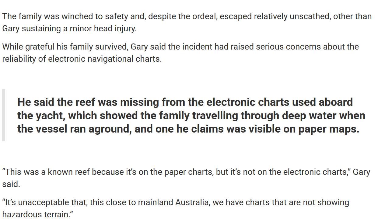
The owner of the yacht that sank reported that their paper charts had the reef but the electronic charts didn't. www.mackayandwhitsundaylife.com/article/family-marooned-after-yacht-strikes-reef Not sure if that link is on a pay wall but the main part is copied below. I have paper charts of The Withsundays but it only goes as far East as Cobham Reef which is about 7nm from the reef in question, which is off the page.
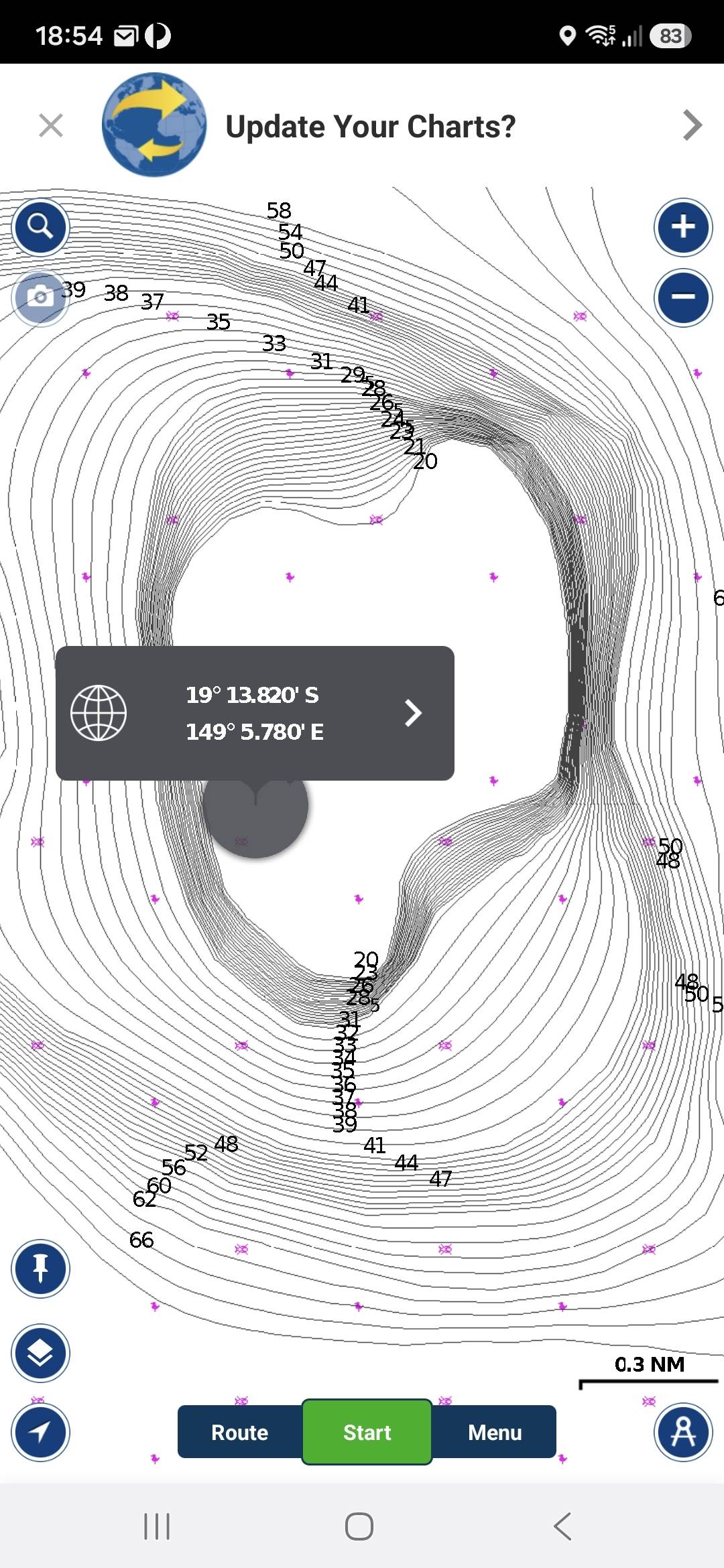
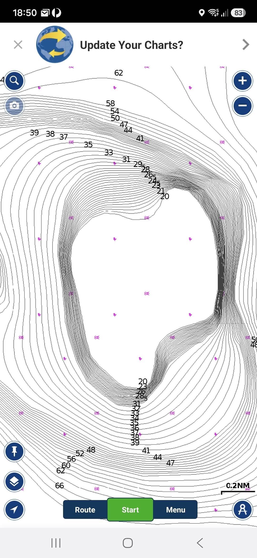
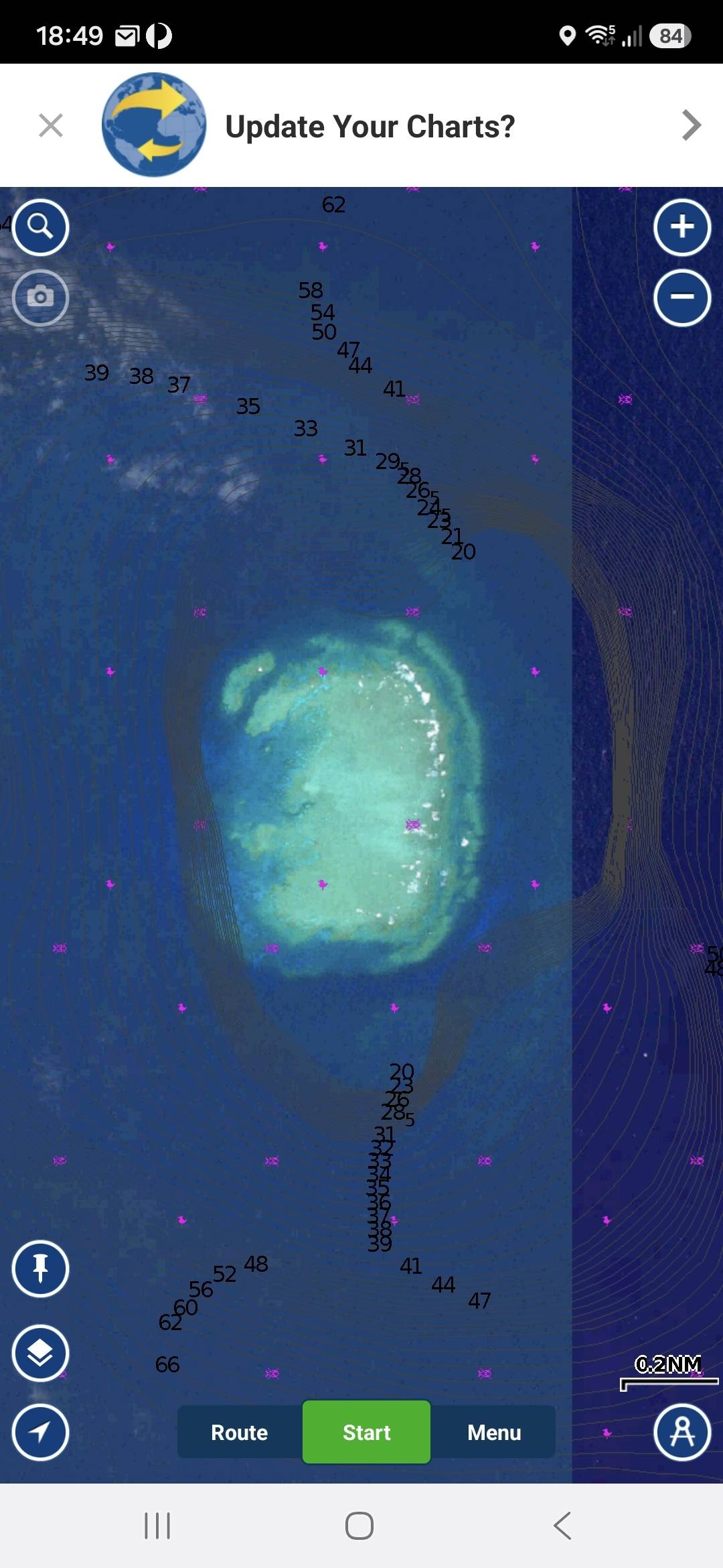
Attached some screenshots from Navionics. Lat and Long from target on AMSA video. It shows clear water at 20 metres deep. When I Map Options, Overlay Satellite Imagery there is obviously a reef there. Sean
I anchored at Shark Bay on 11th August. On the trip up from Airlie winds were steady at 7 knots SE. Predict Wind had the following days wind as NE at <5 knots. As we were about to drop anchor the SE winds quickly picked up to 23 knots and stayed at that level for a couple of hours and then slowly dropped back. By morning it was glassy seas and we had <5 knots NE for the next leg north. I put it down to a change in the weather systems creating a 'front' when it changes direction from SE to NE or variable. I have anchored there previously in strong SE winds and did get 'bullets' of wind whistling through the valley but this was not the case on my last visit. Sean