Dry Winter: Clearer Water Through August

In short
El Niño is driving below-average rainfall across eastern and southern Australia through August, reducing sediment runoff into estuaries and coastal waterways.
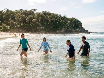
Divers, estuary anglers and offshore fishers can expect cleaner, clearer water than usual across NSW, VIC and QLD for the remainder of winter.
What to watch
The positive Indian Ocean Dipole (IOD) signal building alongside El Niño reinforces the dry outlook - conditions could remain settled well into spring.

El Niño is underway in the tropical Pacific, and it is rewriting the rule book for winter water quality around Australian coasts.
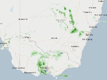
Bureau of Meteorology's June-August 2026 outlook puts below-average rainfall at 60 to 80 per cent likelihood across southeast Queensland, eastern NSW, most of Victoria, southern South Australia and eastern Tasmania.
For water users, that forecast carries a practical upside that gets little attention: less rain means less runoff, and less runoff means clearer water.
Why rainfall governs what you see underwater
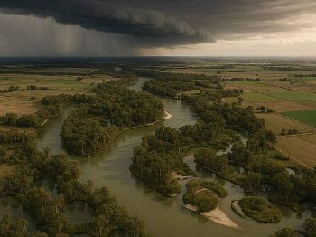
Every millimetre of rain that falls on coastal catchments picks up sediment, tannins from leaf litter, and nutrients as it drains to sea.
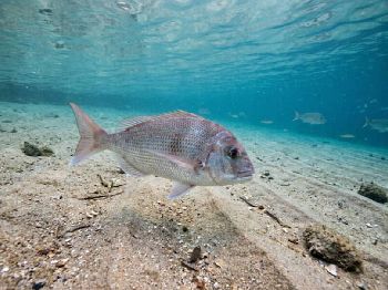
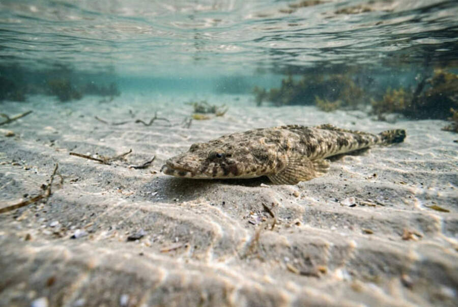
In estuaries, that process stains the water brown, drops visibility and temporarily pushes species like flathead, bream and mulloway tight to structure.
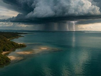
On shallow reefs and dive sites within 5 kilometres of a river mouth, a single east coast low can cut visibility from 12 metres to 2 metres in 24 hours.
Winter is already the best season for underwater visibility along the NSW and Victorian coast - the heavy summer convective rainfall that produces most of Australia's runoff has passed.
With El Niño now suppressing even winter rainfall events, that visibility window extends and deepens compared to an average year.

"Visibility at Sydney's eastern dive sites peaks from April to September, with over half of all dives recording more than 10 metres - and dry spells make the top end of that range achievable even after fronts."
The atmospheric driver and its trajectory
El Niño strengthens the high-pressure ridge over southeastern Australia, steering frontal systems further south and suppressing the instability that generates east coast troughs.
That mechanism is straightforward - what makes 2026 unusual is the positive Indian Ocean Dipole (IOD) signal developing alongside El Niño, according to BOM seasonal models.
A positive IOD typically reinforces dry conditions across southeast Australia in winter and spring by reducing moisture flowing into the continent from the northwest.
BOM notes that around half of current climate models indicate this El Niño event could peak at levels among the strongest observed since 1950.
The combined IOD and El Niño signal means the dry pattern is not expected to break before September - giving fishers and divers a roughly 10-week window of consistently lower runoff.
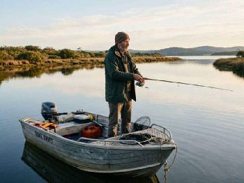
What it means for estuary fishing
Clear, high-salinity water in winter estuaries changes how species distribute and feed.
Flathead on lures become significantly more catchable in cleaner water - fish can track a soft plastic further and hold position in open sand rather than hugging turbid margins.
Bream in clear estuaries tend to feed earlier in the morning and later into the afternoon, with less reliance on dirty water to ambush prey.
Mulloway, which push into estuaries on the change of tide, are most reliably caught in conditions where visibility is at least 0.5 metres - conditions a dry winter reliably produces across the Hawkesbury, Shoalhaven, Gippsland Lakes and Brisbane systems.
Species that benefit from cleaner conditions include yellowfin bream, dusky flathead, tailor and - from rock platforms - drummer and luderick feeding on weed-covered ledges exposed by clear, settled swell.
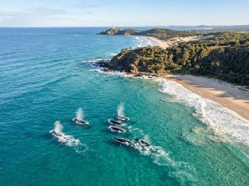
Diving conditions: which sites gain most
Dive sites directly downwind or downstream of river mouths gain the most in a low-rainfall winter.
Sydney sites such as Bare Island, Gordon's Bay and Clovelly all sit close enough to stormwater drains and river outlets that a heavy rain event reliably cuts visibility for 48 to 72 hours after the event.
In a drier winter, those recovery windows extend: visibility can hold above 8 metres for a week or more between fronts rather than resetting every few days.
Visibility at reefs in the Port Stephens to Jervis Bay corridor - including sites like Magic Point and the Pinnacle - will likely run at or near their winter peak through the period.
In Victoria, the Mornington Peninsula's Rye Pier and the Pope's Eye at Port Phillip entrance see similar dynamics: rain events from trough passage cloud Port Phillip Bay's shallows, and a dry winter keeps that bay-side silt load suppressed.
Queensland's Moreton Bay, Flat Rock and Mooloolaba sites benefit from less freshwater flushing out of the Brisbane and Noosa river systems.
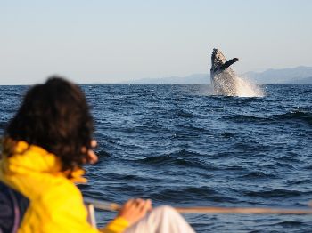
 Offshore and temperature context
Sea surface temperatures along the NSW and eastern Tasmania coasts are running 3 to 4 degrees Celsius above average, according to BOM ocean analysis.
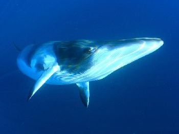
That anomaly means offshore structure - FADs, seamounts, shelf break - is holding pelagics like yellowfin tuna, mahi mahi and striped marlin in the 100-metre line at latitudes where they would normally push north through July.
The combination of abnormally warm SSTs, reduced coastal freshwater input and El Niño's characteristic strengthening of the East Australian Current creates a winter offshore season that has few historical analogues.
Warm water pelagics including yellowfin tuna and striped marlin have been observed closer to shore and at higher latitudes than usual for June, consistent with the 3 to 4 degree SST anomaly recorded by BOM.
How long does it last?
BOM's current models do not indicate a significant pattern break before late September.
The most likely scenario is a gradual weakening of El Niño pressure from September onward as spring warming destabilises the high-pressure ridge and instability returns to the east coast.
For planning purposes, the reliable window for cleaner inshore water runs from now through late August - roughly 10 weeks - before the transition into spring increases the chance of east coast trough events and associated runoff.
Watch the BOM ENSO outlook from late August: a faster-than-expected weakening of El Niño could bring earlier-than-normal spring rains, collapsing the visibility window by mid-September rather than late October.
Track marine forecasts and plan your sessions via the Seabreeze NSW warnings page and wind forecasts .
FAQ
Does drier weather mean calmer conditions offshore? Not necessarily - El Niño tends to bring more frequent, deeper high-pressure systems that produce strong southerly winds between fronts, especially on the NSW coast. Calm doesn't automatically follow dry.
Will visibility improve everywhere at once? No. Local turbidity depends on catchment size, proximity to stormwater drains, and tidal mixing. Sites further from large river mouths respond faster and more consistently.
Can I still get blocked out by a front? Yes. El Niño reduces the frequency of rain events but does not eliminate them. Cold fronts still cross southeastern Australia in winter - they just carry less moisture and produce shorter, sharper rainfall bursts rather than sustained multi-day events.
What about WA? Western Australia's southwest receives most of its rainfall from cold fronts that track across the Bight in winter. Below-average rainfall is forecast for the South West Land Division, meaning similar visibility benefits apply to sites around Rockingham, Rottnest and the Leeuwin corridor.