East coast settles as the high builds in
In short
A cold front has cleared the New South Wales coast and a big high is building in behind it to settle the weather into the weekend.
Expect frosty inland mornings, winds easing from the southwest to light southerlies, and a southerly swell slowly dropping from 2 to 3 metres.
What to watch
The calm has a use-by date, with the next front set to brush the south early next week as the high slides into the Tasman.
The east coast has swapped a run of frontal weather for a settling spell, and the timing suits anyone planning a weekend on the water.
A cold front cleared the coast midweek, and a large high pressure system is now building over southern Australia to steady the pattern through to the weekend.
The Bureau of Meteorology has southwesterly winds of 15 to 20 knots (28 to 37 km/h) behind the front today, easing to lighter southerlies of 10 to 15 knots tonight.
Its Sydney coastal waters forecast, issued at 4am on Thursday, keeps a southerly swell of 2 to 3 metres running while the seas drop back to around 1 metre by afternoon.
Why the high settles the coast
A high pressure system sinks air, which clears the cloud, calms the wind and lets overnight heat escape to space under a clear sky.
That is why the settled days come with cold, frosty starts inland, as temperatures fall away fast once the sun goes down.
The high drifts across the southeast over the next few days before sliding into the Tasman Sea, keeping the weekend mostly quiet.
The swell is a different story, because that southerly groundswell was generated by the front and earlier systems well out in the Southern Ocean.
"The wind drops long before the swell does, so the calmest looking morning can still deliver the biggest set of the day."
How the next few days play out
Friday sees the southerly ease early before freshening again to 15 to 20 knots ahead of dawn, with the swell holding near 2 to 2.5 metres.
Saturday and Sunday should settle further as the high moves overhead, bringing light winds, sunny afternoons and sharp overnight frosts inland.
The next cold front is lined up to brush the state's south early next week, so this quiet window is the one to use.
What it means on the water
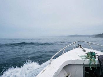
For boaters, the light winds are inviting, but a 2 to 3 metre southerly swell still stacks up steeply at exposed bars and coastal entrances.
Check the bar before you commit, cross on the top of the tide, and remember that a calm sky does nothing to shrink a solid groundswell.
For surfers, south-facing beaches and points will keep catching that leftover southerly swell, with the cleanest waves early before the sea breeze builds.
For fishers, the churned, cooler water after a front often fires up tailor, Australian salmon and bream along the beaches and rock ledges.
Work the deeper gutters and the edges of the whitewater where the swell stirs up food, and fish the low light at dawn and dusk.
Respect the leftover swell
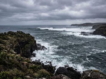
The biggest trap this weekend is complacency, when light air and sunshine make a 2 to 3 metre swell look smaller than it really is.
Rock fishers should never turn their back on the sea, should wear a lifejacket and cleated boots, and should pick a ledge with high, dry escape ground.
Winter water is cold enough to sap strength quickly, so dress for immersion and keep a close eye on anyone near the edge.
Common questions
How long will the calm last?
Through the weekend, before the next cold front reaches the state's south early next week and stirs the pattern up again.
Why is it so cold in the mornings?
Clear skies and light winds under the high let overnight heat escape, so inland areas wake to widespread frost.
Why is the swell still up on a calm day?
Groundswell travels for days from distant fronts, so the ocean stays lively long after the local wind drops away.
Plan your window with the Seabreeze Sydney wind forecast , and check the latest NSW coastal warnings before you head out.

NSW South Swell Builds: Front Clears Friday
SW 20-30kt and 2-3m swell Thursday, clean weekend