NSW North Coast: Hazardous Surf Warning

In short
A coastal trough has deepened into a low pressure system off the northern NSW coast, generating 3 to 4m seas offshore between Point Danger and Smoky Cape.
BOM's Hazardous Surf Warning is in effect, with bar crossings rated dangerous for all vessels through at least Monday evening.
What to watch
The system is forecast to ease from Tuesday as a strengthening high pressure ridge dislodges the coastal low eastward into the Tasman.
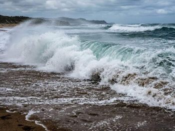
A deepening Tasman Sea low has locked the NSW north coast into a sustained heavy surf event, with the Bureau of Meteorology issuing a Hazardous Surf Warning for the stretch from Point Danger to Smoky Cape since Saturday.
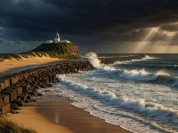
Seas offshore north of Coffs Harbour are running 3 to 4 metres, with inshore areas holding around 3 metres and a dominant south to southeasterly swell of 1.5 to 2.5 metres stacked on the background groundswell.
Winds are running south to southeasterly at 20 to 25 knots across NSW Northern Coastal Districts, gusting to 30 knots in exposed offshore waters south of Yamba.
The central concern for boaters is bar crossings: BOM has classified river and harbour entrances across the northern zone as hazardous for all vessel classes through Monday, not just small craft.
Clarence River at Yamba, Brunswick Heads, Ballina Bar, and the Tweed River entrance are all within the warning zone, with wave surge on exposed entrance channels typically amplifying well above the offshore swell reading.
"Large and powerful surf conditions are expected to be hazardous for crossing bars by boat and rock fishing across the NSW north coast."
The warning area extends north into Queensland, where Sunshine Coast offshore waters are tracking 2 to 3 metres with a continuing southeasterly wind pattern and similar bar hazard implications for Noosa and Mooloolaba.
How the east coast low formed
The event traces to a coastal trough that developed along the northern NSW coast late last week, consistent with a classic winter synoptic pattern on the eastern seaboard.
By Saturday the trough had intensified into a low pressure system near the northern Tasman Sea - a development known as an East Coast Low, and one of the most significant weather producers on the entire eastern seaboard.
East Coast Lows develop when a cold upper-level trough undercuts warm, humid air pooled against the Great Dividing Range and coast, triggering rapid development that can deepen a surface low by 15 hPa or more within 24 hours.
This event was moderate in its development, but enough to establish a sustained onshore SE wind fetch running from the Tasman directly into the exposed north coast, with fetch distances exceeding 1,500 km at the peak.
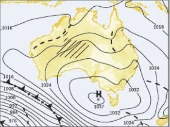
A blocking high pressure ridge positioned over southern Australia stalled the system's eastward exit, extending the swell window through the weekend and into Monday rather than allowing the low to track away normally.
The blocking pattern is now beginning to break down, with the southern high strengthening and forecast to push the coastal low east and away from the coastline from Tuesday morning.
Fishers: bars, estuaries, and the alternative session
Offshore sportfishing from Port Macquarie north is effectively on hold for Monday, with bar conditions ruling out safe access to the productive pelagic grounds for all but the most capable offshore vessels.
Yellowfin tuna and dolphinfish have been running 20 to 45 nautical miles offshore in warm Tasman eddy water, but reaching them today requires clearing a hazardous bar first.
Rock platforms from the northern beaches through to the Queensland border carry extreme risk through Monday, with BOM's Hazardous Surf Warning specifically calling out rock fishing as a high-danger activity during this event.
Commercial offshore charter operators out of Yamba and Ballina have postponed weekend runs, citing bar crossing conditions that make departures unsafe regardless of the offshore forecast quality.
Estuary fishing is the session worth having: flathead, bream, and luderick are holding throughout the river systems behind the bars, where freshwater flush from coastal runoff pushes fish toward deeper holes and the lower salinity boundary in the middle estuary.
Work the lower estuary channel edges where salt and fresh water are mixing - feeding activity tends to concentrate at that salinity interface when coastal rain and runoff accompany the swell event.
Surfers and kiters: reading the swell
For surfers prepared to handle the conditions, the north coast is producing some of the most organised large surf of the winter season.
North-facing beaches and protected bays between Byron Bay and Cabarita are receiving well-shaped groundswell from the SE, where headland geography takes the worst of the wind chop off the face and organises the sets.
The dominant SE swell period is tracking 12 to 14 seconds - long enough to produce significant refraction and wrap around headlands, with face heights at exposed points running considerably above the offshore swell reading.
Shortboarders and longboarders will find the best windows early before the seabreeze reinforces the southeasterly trade already running in the morning hours.
Kiters and windsurfers have strong, consistent SE winds but conditions in open water are messy with short-period wind swell stacking on the groundswell - protected bays with a side-shore angle are the call for today.
Divers and sailors: the sheltered site call
Dive charters at Julian Rocks, Cook Island, and other north-facing sites are making careful site selection calls this morning.
Visibility at exposed headlands and offshore pinnacles will be significantly reduced by surge and current, with post-swell sediment typically staying in the water column for 24 to 48 hours after the peak.
Protected bay sites and dives on the southern sides of headlands offer better options today, though elevated ambient current should be factored into any drift dive plan.
Coastal passages north of Cape Byron should be treated as a two-day wait: bar entries aside, the sea state offshore in 3 to 4m conditions with a chop overlay is uncomfortable for most coastal yachts and requires careful preparation.
Sailors transiting south along the coast have a more usable weather window from Cape Byron southward this afternoon as winds ease slightly from the morning peak, but bar conditions at any coastal port remain the critical constraint.
Outlook and window planning
The Bureau of Meteorology forecasts the low to continue easing from Tuesday morning as the blocking high extends northward and dislodges the system east into the Tasman.
Winds are expected to drop toward 15 to 20 knots through Tuesday, with seas moderating from 3 metres toward 2 metres by Wednesday offshore.
Bar crossings across the northern zone should return to manageable conditions from mid-Tuesday, subject to the overnight swell run easing as forecast - always confirm conditions at your specific bar before departing.
Thursday and Friday are shaping as the cleaner offshore window before the next frontal sequence, currently positioned in the Southern Ocean, moves up the eastern seaboard toward the weekend.
What exactly is a Hazardous Surf Warning?
BOM's Hazardous Surf Warning is issued when surf conditions are dangerous for all coastal activities, not just ocean swimming - it specifically covers bar crossings, rock fishing, and coastal navigation by all vessel sizes.
The warning sits a step above a Strong Swell Advisory and means conditions are objectively dangerous, not merely uncomfortable or inconvenient for small craft.
Why do bars get so dangerous when the offshore swell reading is only 3m?
Bars are where deep ocean swells meet shallow sand: wave height transformation over a shallow entrance can amplify a 3m offshore swell into breaking waves of 5m or more over the berm depending on the bar shape and tidal stage.
Swell arrives in sets - typically three to five waves in a group - and a lull that looks safe can be followed by the largest set of the day within seconds of a vessel committing to the entrance.
Track NSW coastal conditions at NSW marine warnings on Seabreeze, and check your departure port tides before any coastal run this week.