Kunanyi -1.8 as Tasmania's snow line falls

In short
The kunanyi / Mount Wellington Pinnacle station sat at -1.8° at 9am Tuesday with an apparent temperature of -12.8°.
A cold front has pulled a southwesterly airstream over Tasmania, lowering the forecast snow level towards 400 m in the south and placing strong wind warnings on almost every coastal zone.
What to watch
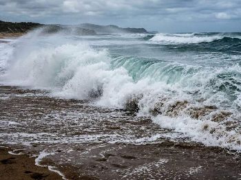
Southwest swell off the South East Coast building to 3-5 m during Tuesday, then 4-6 m on Wednesday.
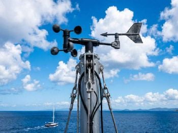
The Bureau of Meteorology's automatic weather station at the kunanyi / Mount Wellington Pinnacle, 1260 m above Hobart, recorded -1.8° at 9am Tuesday with humidity at 98 per cent.
The apparent temperature at that height was -12.8°, which tells you far more about standing on the summit than the air temperature does.
The west coast told a wetter story, with Mount Read at 1119.5 m logging 21.4 mm over 24 hours and sitting at -0.7° in calm air with 100 per cent humidity.
Liawenee, at 1057 m on the Central Plateau, sat at 1.8° after a minimum of -0.9°, with an apparent temperature of -4.3° and 2.4 mm of rain.
Hartz Mountain at Keoghs Pimple, 831 m in the far south, was barely above freezing at 0.1° with a westerly of 26 km/h.
The snow line, and what sits on it
Scotts Peak Dam, at 408 m, read 4.5° at the 9am observation after 7.2 mm of rain.
The district forecasts put snow above 300 m in the west and above 400 m in the Upper Derwent and South East, so Scotts Peak is sitting almost exactly on the line.
That matters for anyone towing a boat, because the plateau lakes, Lake Pedder and the west coast launch spots all fall inside the snow shower and small hail window on Tuesday.
At sea level it is a different story, with Hobart Airport at 2.2 m reading 9.6° and 60 per cent humidity, and no rain in the 24-hour gauge.
Hobart's Ellerslie Road site, 50.5 m up, recorded 8.2° with an apparent temperature of 2.8° and a north-northwesterly of 20 km/h.
A bushwalker alert is current for the Western and Central Plateau districts, along with a road weather alert and a sheep graziers warning for the South East.
Bush walkers are advised that snow as low as 400 metres is expected during Tuesday.
The road alert covers the Central Plateau, Upper Derwent Valley and South East, and warns that snow covered roads will make driving conditions dangerous during Tuesday.
The graziers warning flags cold temperatures, rainfall and strong westerly winds, with a risk of losses among lambs and exposed sheep in the South East district.
Why the cold is here
The state forecast, issued at 4:00am, has a southwesterly flow covering Tasmania in the wake of a cold front, with scattered showers in the west and south.
Showers are isolated elsewhere and should ease during the evening, with thunderstorms possible in the southwest and northeast and small hail possible in the west and south.
Snow was forecast to around 700 m in the morning, lowering through the day to about 400 m in the south and 500 m in the north.
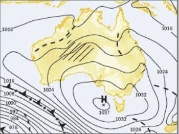
A ridge arrives Wednesday, as a high in the Great Australian Bight extends over the state, with Central Plateau snow possible above 600 m and overnight minimums of -4° to 1°.
Boaters, fishers and sailors
The 4:00am marine wind warning summary carries Strong Wind Warnings for almost every Tasmanian coastal zone, including Storm Bay, the Channel, the East Coast and the South East.
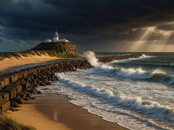
For the South East Coast between Tasman Island and South East Cape, the marine forecast has westerlies of 25-30 knots turning southwest around midday with seas of 2.5-3 m.
Swell there is forecast west 3-4 m tending southwest 3-5 m during the morning, then building to southwest 4-6 m on Wednesday with 20-30 knots behind it.
Note the timing, because the swell peaks on Wednesday as the wind eases slightly, which is the classic trap for anyone judging a bar crossing on wind alone.
Ramps on the lower Derwent and the western shore of Storm Bay are exposed to west-southwest chop, and the South East district forecast has winds of 30-45 km/h over land.
On the Central Plateau Lakes, the local waters forecast has 15-20 knots of west wind turning southwest, with a 90 per cent chance of snow showers and possible small hail.
Visibility inside a snow shower on Great Lake can close down to almost nothing, and the air at Liawenee was 1.8° when boats would be launching.
Cold water is the real hazard on a day like this, because immersion at plateau lake temperatures removes useful swimming ability within minutes.
Marine and Safety Tasmania is the state's recreational boating safety authority, and its lifejacket and safety equipment rules apply to every small craft on these waters.
Hobart and the Derwent
The Hobart forecast, issued at 4:15am, has a very high chance of showers from late morning, a chance of a thunderstorm and possible small hail.
Winds were west to northwest at 15-25 km/h tending west to southwest at 20-30 km/h, with a city maximum of 12°.
Rainfall of 2-7 mm is forecast at a 95 per cent chance, with Bellerive at 13°, Glenorchy and Kingston at 11°, and kunanyi / Mount Wellington at 2°.
Frequently asked questions
How low will the snow go on Tuesday?
The state forecast has the level lowering to around 400 m in the south and 500 m in the north, with falls above 300 m in the west.
Are there marine warnings for Storm Bay and the Channel?
Yes, both carry Strong Wind Warnings on Tuesday.
When does the swell peak on the South East Coast?
Southwest swell reaches 4-6 m on Wednesday, a day after the strongest westerly winds.
Should I launch on the plateau lakes?
Snow showers, small hail and 15-20 knots of west to southwest wind make it a poor day for small open boats.
Track the live picture on our Tasmanian weather warnings page and plan your next session with the Hobart wind forecast .