MJO Fires East Coast Swell: Plan Your Week

In short
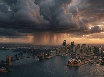
A BOM Hazardous Surf Warning covers five NSW coast zones through Tuesday, with Sydney swell building to 3-4 metres as a cold front and low-pressure system push up from the south.
The driver sits thousands of kilometres away: an active Madden-Julian Oscillation (MJO) in the western Pacific triggered Rossby waves that drew cold polar air toward southeastern Australia.
What to watch
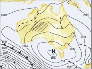
A high-pressure system is moving in from the Bight - expect conditions to settle from mid-week, opening a potential offshore window for fishers and sailors by Thursday or Friday.
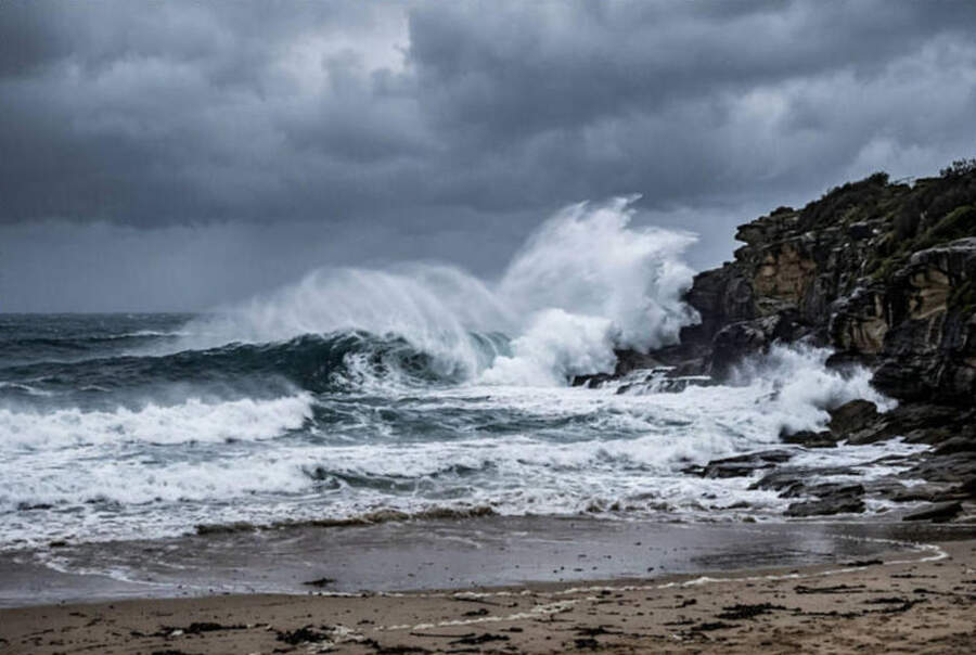
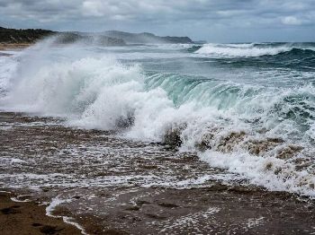
Sydney coastal waters are running 2.5 to 3 metres of southerly swell Sunday morning, building to 3 to 4 metres through the day, according to the Bureau of Meteorology.
Bass Strait is running larger, with west to southwesterly swell of 2.5 to 4 metres and seas rising to 4 to 6 metres in the far west by Sunday afternoon.
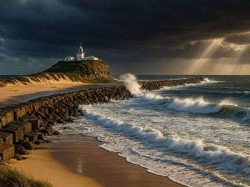
A BOM Hazardous Surf Warning is in effect from Sunday, July 6 through Tuesday, July 8 for the Macquarie Coast, Hunter Coast, Sydney Coast, Byron Coast, and Coffs Coast.
Rock fishers are advised to avoid exposed ocean-facing platforms entirely and seek sheltered locations.
Boaters planning bar crossings are advised to delay voyages. Conditions are hazardous and bars are running large across all five warned zones.
Queensland sees its own pulse arriving from Monday: a significant south to southeasterly swell is expected to develop about the far southeast coastal waters, easing gradually from mid-week.
What triggered it: the MJO explained
The cold front and accompanying swell were not random.
The Madden-Julian Oscillation - a pulse of tropical heat and rainfall that circles the globe roughly every 30 to 60 days - was active in Phase 7 over the western Pacific in late June and early July.
When the MJO fires strongly in the western Pacific, it releases an enormous amount of atmospheric heat.
That heat disturbs the atmosphere on a planetary scale, sending pressure waves - Rossby waves - spreading outward toward the mid-latitudes.
For every surge of warm tropical air moving upward and outward, cold polar air gets drawn northward to replace it.
In winter, that response is felt hard across southeastern Australia: cold outbreaks, snowfalls in the ranges, and large Southern Ocean swell pushing up the east coast.
When the MJO sits in phases 6 or 7 over the western Pacific in winter, the probability of a cold outbreak - and elevated Southern Ocean swell - for south-east Australia rises in the following week, according to Bureau of Meteorology climate research.
The Bureau of Meteorology monitors MJO phase on a rolling basis at its climate pages, using an eight-phase diagram that shows where the active convection pulse currently sits.
Phases 6 and 7 - centred over the western Pacific - carry the strongest link to cold outbreaks and elevated Southern Ocean swell for eastern Australia.
What it means for your session this week
Surfing: Three to four metres is solid pumping surf at south-facing and east-facing breaks from Sydney to Byron Bay through Sunday and Monday.
Exposed breaks are in the overhead-plus range - not a weekend for beginners or those unfamiliar with the break.
Select sheltered points and south-facing headlands for the best shape and the best protection from the strong southerly winds.
As the high pressure moves in from mid-week, size should ease back to the 1 to 2 metre range - cleaner, more manageable surf for most skill levels.
Fishing: Offshore and bar crossings are off the table for Sunday and Monday across all five warned zones.
Estuary and sheltered waterway fishing looks good - southerly swells push bream, flathead, and whiting into the heads and lower reaches of estuaries where current and silt stir up baitfish.
The approaching mid-week window - as the Bight high settles over the southeast - is worth watching for a quality offshore run late in the week.
Sailing: The weekend is for sheltered water only along the NSW coast and Bass Strait.
Coastal passages from Sydney southward face 3 to 4 metre swells and southerly winds building to 25 to 30 knots through Sunday afternoon - Category 2 territory for small vessels.
The mid-week high should deliver the kind of settled 10 to 15 knot northerly or nor'easter that makes for excellent downwind passages from Sydney toward the Hunter or central coast.
The week ahead: reading the opening
A high-pressure system is currently strengthening over the Bight and tracking east toward Tasmania.
This pattern - deep southerly swell followed by clearing high pressure - is a classic July sequence for southeastern Australia when the MJO is active in the western Pacific.
The MJO cycle runs 30 to 60 days, meaning the next active pulse through the western Pacific could fire another cold outbreak and swell event in late July to mid-August.
Forecasters and regular offshore runners are already watching the mid-range models for the next window.
The current Niño3.4 index sits at +1.24°C - well above the El Niño threshold - and the SAM (Southern Annular Mode) has been positive, keeping westerly storm tracks south of Australia.
Together, these drivers have kept much of winter drier and calmer than average, with swell events arriving in tight windows rather than through extended runs of consistent surf.
The practical consequence: offshore fishing, passage sailing, and bigger surf arrive in windows - predictable, if short.
Tracking MJO phase, SAM index, and synoptic patterns gives a genuine 7 to 14-day planning advantage that raw daily forecasts miss.
Questions
How do I track MJO phase myself? The Bureau of Meteorology publishes a live MJO phase diagram at bom.gov.au/climate/mjo - check it weekly during winter for a forward-looking swell and cold-outbreak signal.
When will the swell ease? Based on current synoptic models, Sydney swell should ease back to 1.5 to 2.5 metres from Wednesday, July 8, as the high-pressure system clears Bass Strait.
Is southeast Queensland affected? Yes - a significant south to SE swell is expected to develop from Monday and ease gradually through mid-week. Bars south of Brisbane are at risk over Monday and Tuesday.
What does the next two weeks look like for offshore fishing? A potential window is developing for Thursday to Friday this week as the high consolidates. The following week looks less settled as the next system approaches from the Southern Ocean.
Track the latest swell forecasts and coastal warnings via Seabreeze NSW warnings and the Seabreeze wind and swell forecast pages.