Bass Strait Swell: Vic Bar Windows This Week

In short
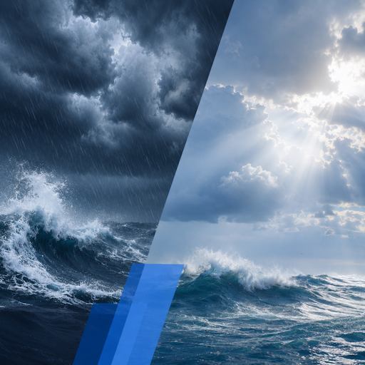
A deep low northeast of Tasmania drove damaging southwesterly winds across southern Victoria on Thursday, with Bass Strait now running 2 to 4 metres and bar crossings elevated from the Great Ocean Road to East Gippsland.
Conditions ease Saturday afternoon as the low tracks toward New Zealand, opening a brief offshore window for Sunday.
What to watch
Track the swell trend closely - a fresh front follows early next week, so the window is narrow.
A Bureau of Meteorology severe weather warning was issued at 10:29 am on Thursday, 4 June, for damaging winds across southern Victoria, with gusts reaching 90 km/h along the south west coast.
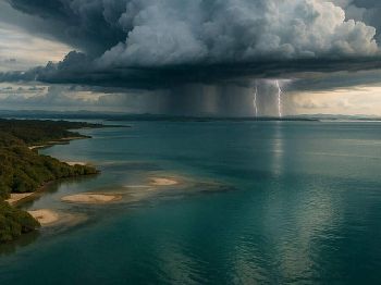
The driver is a deep low pressure system sitting northeast of Tasmania at 987 hPa, extending a trough directly through Bass Strait and funnelling cold southwesterly air across Victoria's open coast.
Winds averaged 60 km/h through the afternoon, with the strongest gusts focused between Portland and Cape Otway before easing after dark.
What the swell is doing now
Bass Strait swell built through Wednesday night and is now running 2 to 4 metres on a south to southwest direction, with a period of around 8 to 10 seconds.
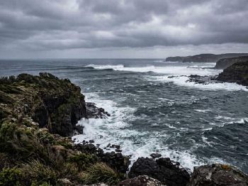
On the eastern Tasmanian flank, seas climbed from under 1 metre early Thursday to 3 to 5 metres by midday, with BOM describing conditions as hazardous for bar crossings and rock fishing.
Victoria's open coast catches the full southwest fetch, so the energy arriving at exposed harbour entrances is near the upper end of that range through Friday.
Bars most affected
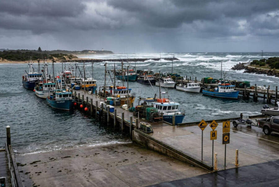
Lakes Entrance is the main concern - southwest swell runs directly at the bar entrance at this angle, and the bar can shoal quickly under sustained energy from this direction.
Vessels considering crossing should radio Maritime Safety Victoria on VHF 16 for the latest bar report before departure, and time any crossing to the first two hours of the flood tide.
Apollo Bay harbour faces southwest and is exposed to this swell direction, with surge entering the boat harbour in larger sets.
Port Phillip Heads (The Rip) is a tidal passage rather than a surf bar, but southwest swell stacking against an outgoing tidal flow creates short, steep and confused seas that make crossing in the wrong tidal window hazardous.
The safest window through Friday and Saturday morning is during the first two hours of the flood tide, when the swell and tidal flow align rather than oppose each other.
"A burst of strong southwesterly winds sweeps across southern Victoria associated with the trough, before winds abate later in the evening - but swell takes significantly longer to settle." - Bureau of Meteorology, Victoria Severe Weather Warning, 4 June 2026
Rock fishing and coastal safety
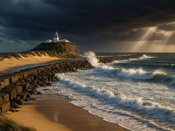
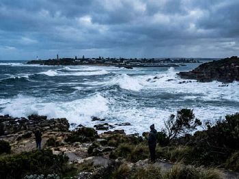
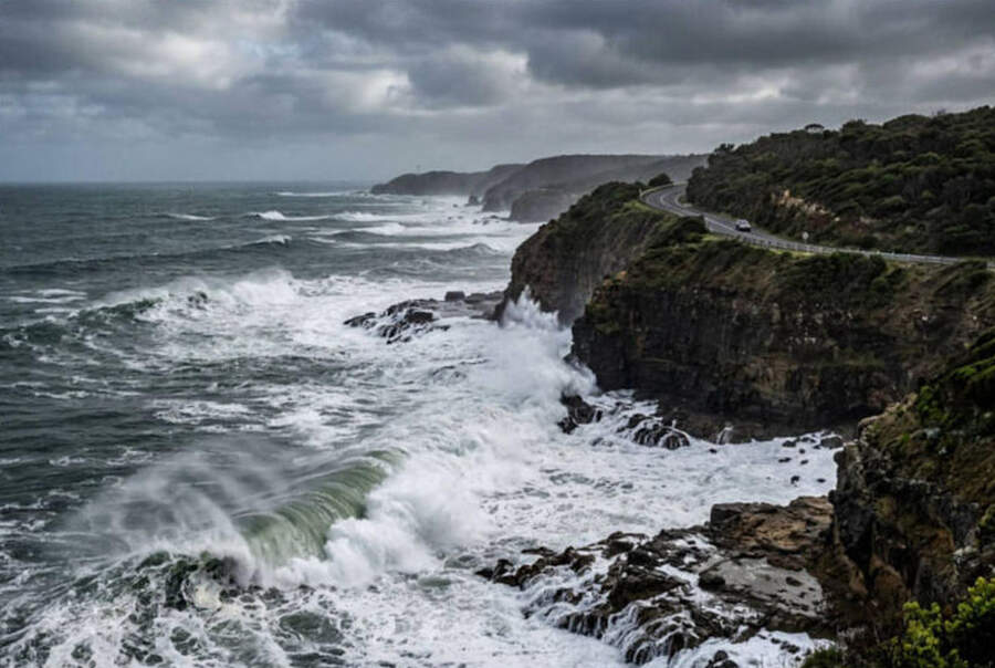
The Great Ocean Road from Lorne to Cape Otway is carrying heavy surge today, with popular rock platforms directly in the path of 3 to 4 metre sets.
Rock fishers targeting salmon, sweep and trevally in this region should treat exposed platforms as off limits until Sunday at the earliest.
Surge is the hidden risk in these conditions - the visible wave face gives no reliable indication of the water that climbs the rocks behind it.
What the synoptic pattern means
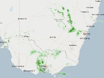
The Indian Ocean Dipole is in a neutral phase this winter, according to BOM's June climate outlook, which means southern Australia is tracking close to the typical number of cold fronts from the Southern Ocean.
That translates to roughly fortnightly fronts through July and August, with this pattern of brief open windows between systems being the norm rather than the exception for Victorian coastal users.
The current low tracks northeast toward New Zealand by Friday night, and the trailing ridge pushes northwest over Victoria from Saturday afternoon.
The weekend window
Saturday morning is still rough along the open coast - bars remain elevated and swell keeps exposed harbours uncomfortable through mid-morning on Saturday.
By Saturday afternoon, winds back toward light southerly and the swell direction shifts, making Sunday the pick of the window across Bass Strait and the inshore reefs south of the bay.
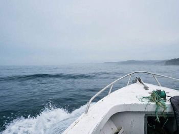
Offshore boats out of Lakes Entrance and Portland have a narrow gap Saturday afternoon through Sunday before the next front approaches early next week.
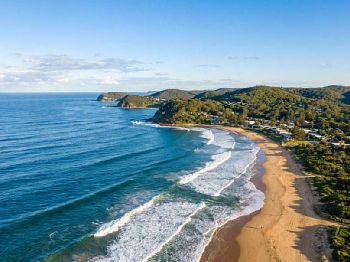
Port Phillip Bay conditions are more manageable throughout the period, with the bay shielded from the direct open ocean swell by the Heads.
Fishing in the window
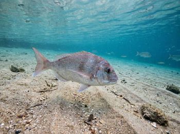
Australian salmon are schooling on Victoria's surf beaches right now, pushed into tight formations by cold mid-winter water temperatures in Bass Strait.
Surf beaches at Inverloch, Kilcunda and the long open run south of Wonthaggi will fish well as swell eases on Sunday - a 40-gram metal slice worked fast through white water is the go-to setup for this time of year.
Snapper are active in Port Phillip Bay's southern basin through winter, with the bite window typically best from one hour before to one hour after the slack of the flood tide.
Keep an eye on the swell forecast for Monday - if the next front sits back, an extra day or two will extend the window further into next week.
Frequently asked questions
Is it safe to cross Lakes Entrance bar this weekend? Saturday morning remains marginal - radio Maritime Safety Victoria on VHF 16 for the current bar report, and cross only in the first hour or two of flood tide.
When does the swell fully ease? Sunday afternoon and Monday show the lowest swell heights in the current outlook, before a fresh system lifts conditions again mid-week.
What about the Rip at Port Phillip Heads? Cross on the flood tide - avoid the ebb completely when swell is above 2 metres from the southwest, as the resulting chop is steep enough to swamp smaller vessels.
Can I fish from the rocks on Saturday? Inshore platforms below the Great Ocean Road remain off limits Saturday morning - check conditions from above before committing to any exposed rock platform this weekend.
Track active warnings through Seabreeze Victoria weather warnings for the latest marine updates as conditions change through the weekend.