Three Fronts Clear: Bass Strait Window Thursday

In short
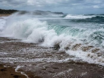
Three cold fronts embedded in the mid-latitude westerly belt are crossing Bass Strait in rapid succession, with rough conditions - 25-30 knots and 2-3m seas - expected through Wednesday.
A high pressure ridge develops over Tasmania on Thursday, flipping the flow to west-northwesterly and giving the week's best window for Bass Strait crossings and The Rip.
What to watch
Thursday's ridge is narrow - if another trough develops in the westerlies behind it, the window could close again by the weekend.
Bass Strait is doing what it always does in the heart of winter: delivering fronts in series, each one riding the mid-latitude westerly belt that circles Antarctica and drives southeastern Australia's weather from June through August.
Three cold fronts have crossed the strait in quick succession since the weekend.
The first cleared Tasmania on Sunday, leaving behind a strong and gusty westerly airstream across the strait.
The second, embedded deeper in the westerly flow, crosses during Monday, bringing a much colder airmass into the region, according to the Bureau of Meteorology forecast issued at 5:15 pm EST on Sunday 12 July 2026.
A third, weaker system is forecast to cross during Wednesday, pushing a fresh southwesterly through before clearing.
The window
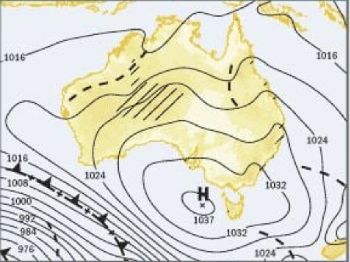
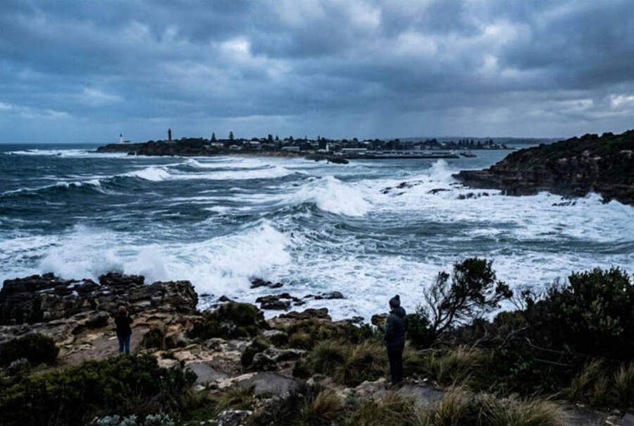
After that, a high pressure ridge develops over Tasmania on Thursday, directing west to northwesterly flow across the state - and that is the week's target window.
Port Phillip Bay and the Victorian coast are likely to feel the benefit a day earlier.
The Bight high is forecast to extend a ridge over Victoria from Wednesday, weakening the westerly airstream ahead of Thursday's full improvement across the strait.
For those planning a Bass Strait crossing, Thursday's west-northwesterly window is meaningfully different from the rough westerly and southwesterly conditions that precede it.
"Wind gusts can be 40 per cent stronger than the forecast, and stronger still in squalls and thunderstorms - maximum waves can be twice the forecast height."
That caution, from the Bureau of Meteorology, applies throughout the frontal period from Monday through Wednesday.
The Rip on Thursday
The Rip at Port Phillip Heads is a different calculation to open Bass Strait.
Tidal currents reach 6 knots through the narrow channel, with extremes approaching 9 knots under certain conditions.
West and southwest winds worsen The Rip by pushing sea level up outside the bay, increasing the rate and duration of the ingoing stream.
Thursday's west-northwesterly, by contrast, is more benign at the entrance - the northerly component reduces the direct onshore sea-level push compared with a pure westerly or southwesterly.
Time the transit for slack water - roughly three hours before or after the high water mark - and the combination of improved weather and tide timing could make Thursday the cleanest crossing day of the week.
Check the Bureau of Meteorology tidal stream predictions for Port Phillip Heads before committing to a departure time.
What to do while Bass Strait stays shut
Port Phillip Bay is enclosed enough to stay fishable through much of the frontal period - with limits.
Water temperature is sitting at 16-17°C across the southern bay.
Juvenile snapper - pinkies in the 25-40 cm range - are schooling heavily around the St Kilda breakwall and Princess Pier.
The southern end of the bay, along the 16-metre depth contour where muddy bottom meets broken reef, is holding gummy sharks during daylight hours.
Southern calamari are active on 2.5 to 3.0 jigs, with UV-enhanced white and vibrant orange patterns performing well in the cooler water.
Keep one caution in mind: winds above 15 knots chop Port Phillip Bay fast, producing short-period swell that turns dangerous for vessels under five metres.
The frontal period Monday through Wednesday will push wind gusts well above that threshold at times - check conditions before launching from Sorrento, Mornington, or Queenscliff.
The westerly belt in mid-winter
July and August are peak months for the mid-latitude westerly belt across southeastern Australia.
Cold fronts form along the polar front - the boundary between Antarctic-origin air and the subtropical high - and move northeast, embedding in the westerly airstream before tracking across Bass Strait.
In a typical winter, fronts cross every three to five days.
This week's succession of three systems in under four days reflects the active phase of the westerly belt, where the atmospheric pressure gradient is steeper than usual and fronts are tightly packed.
The Bureau of Meteorology seasonal outlook for July indicates continued active westerly flow is likely across southern Australia.
This is consistent with the current El Nino pattern, which tends to position the westerly belt slightly further south than during La Nina years.
The practical implication for Bass Strait users: short, sharp windows between fronts will define the rest of the month, rather than prolonged periods of settled weather.
Plan for one-to-two day windows, not week-long runs.
Species movement during the frontal period
Strong westerly conditions push current and baitfish movements around the southern bay.
Silver trevally and Australian salmon tend to move into the more sheltered eastern sections of Port Phillip during rough weather - the bay acts as a refuge for baitfish schools, and predators follow.
Snapper bite quality typically improves after a frontal passage, when cooler, cleaner water washes through and dissolved oxygen levels rise.
The 24-48 hours after Thursday's ridge establishes may offer some of the best bay snapper action of the month - particularly along the southern channels where deeper water keeps temperature more stable.
Other Victorian bars
Port Phillip Heads is the most complex crossing on the Victorian coast, but it is not the only one affected this week.
Barwon Heads, at the Barwon River entrance, and Port Fairy are exposed to the westerly swell direction and will be rough through the frontal period.
Portland, in Victoria's southwest, faces the Southern Ocean directly and will feel the full fetch of the westerly swell - 2 to 3 metres offshore, potentially higher in squalls.
For all Victorian bars, Thursday's ridge and the shift to a lighter west-northwesterly is the target.
The Bar Crossing Guide on the Victorian Fisheries Authority website notes that bar crossings should only be attempted in daylight and in forecast conditions below 2 metres significant wave height.
Given that maximum wave heights can be double the forecast average, that standard is not being met through Wednesday.
Frequently asked questions
When is the best crossing window this week? Thursday is the target - the ridge develops over Tasmania and the flow switches to west-northwesterly, the calmest direction of the week. Port Phillip Bay inshore improves a day earlier, from Wednesday afternoon.
Is The Rip safe during the frontal period? Not for recreational vessels.
Currents reach 6 knots under normal conditions, and westerly winds push sea level up outside the bay, compounding the ingoing stream.
Wait for the Thursday window and time the transit for slack water.
What's fishing like inside Port Phillip Bay during rough Bass Strait weather? Productive, within limits. Pinkies, gummy sharks, calamari, and flathead are all active - but watch the 15-knot threshold for small boats. The bay chops up fast when wind arrives.
How long do Bass Strait windows last in winter? Typically one to two days between fronts in the active phase of the westerly belt.
This week's Thursday window may narrow again over the weekend as the next system approaches.
Check the extended forecast before committing to a multi-day passage.
Track the latest Victoria and Bass Strait warnings on the Seabreeze Victoria warnings page .