SE Swell Builds to Gold Coast From Monday

In short
A significant south to southeasterly swell is forecast to develop in the far southeast Queensland waters from Monday July 20, according to the Bureau of Meteorology.
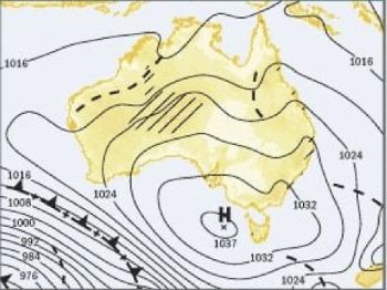
A ridge is holding over southeast Queensland now, keeping inshore seas around 1 metre - the best offshore window this week before the swell arrives.
What to watch
The swell eases gradually from the middle of next week, with south to southeasterly winds of 20 to 25 knots expected as the system tracks through.
The calm period is now. A ridge sitting over southeast Queensland is keeping conditions moderate across the Gold Coast and Tweed Heads waters through this week.
That changes from Monday July 20, when the Bureau of Meteorology is forecasting a significant south to southeasterly swell to develop in the far southeast waters.
Inshore seas are forecast to build from 1.5 to 2 metres, increasing to 2 to 3 metres offshore during the morning as the swell fills in.
South to southeasterly winds will reach 20 to 25 knots at the peak, easing gradually from the middle of next week.
"Maximum waves can be twice the forecast height, particularly at exposed bars and open coastal waters."
That BOM advisory applies throughout the peak period Monday to Wednesday - plan bar crossings and offshore passages around it.
What drives the swell
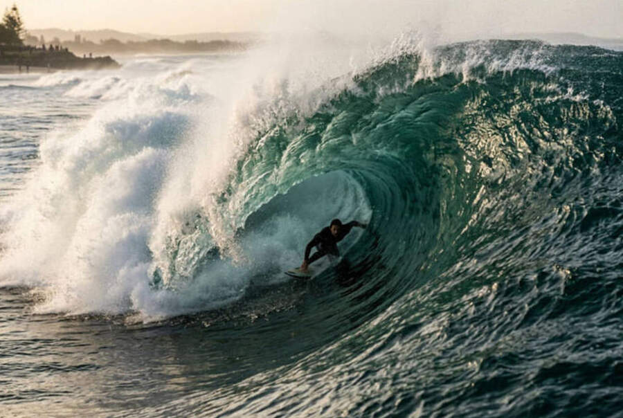
The source is the Southern Ocean. Mid-winter depressions tracking east across the Tasman generate long-period southerly groundswell that wraps up the Queensland coast and reaches the Gold Coast and Tweed Heads.
Southern Ocean groundswell in July typically carries 12 to 16 second periods - the long period delivers powerful, organised lines rather than the lumpy wind chop typical of northeast summer swells.
The Southern Annular Mode has been in a positive phase through mid-winter 2026, based on BOM climate monitoring data.
A positive SAM pushes the westerly wind belt further south, concentrating storm energy into the Southern Ocean and feeding more frequent groundswell events up the Australian east coast.
This event looks consistent with the regularity of swell windows hitting southeast Queensland this winter - a sharp build Monday, a moderate peak Tuesday, and gradual easing through the latter half of next week.
For surfers: where and when
Point breaks will lead the charge. Snapper Rocks, Greenmount, and Kirra are oriented to pick up a south to southeast swell and funnel it into long right-handers along the points.
The southeast swell direction favours the Superbank's full stretch - from Snapper through to Kirra - with each bank activating in sequence as the swell wraps around Greenmount Head.
The best window for clean conditions will be Monday morning before the southerly wind builds, and again from mid-week as the swell eases and the sea surface organises.
Kirra, at the southern end of the bank, offers a slightly less crowded option than Snapper when the swell is running from the southeast - expect the Superbank to be heavily contested from Sunday afternoon as surfers position ahead of the build.
For offshore fishers: use the weekend
The call is this weekend. Saturday and Sunday offer the best bar crossing and offshore conditions ahead of the swell, with the ridge holding seas around 1 to 1.5 metres across the coastal waters.
The Gold Coast Seaway is exposed to a building southerly swell - bar crossings on Monday morning require careful timing and local knowledge as the seas build through the day.
Offshore targets are active now. Warm Tasman Sea surface temperatures sitting above the seasonal average are holding pelagics - mahi-mahi, yellowfin tuna, and wahoo - in winter range, based on sea surface temperature records from CSIRO's Integrated Marine Observing System.
Those fish will scatter when the sea state deteriorates, so the practical offshore window closes as the swell builds Monday.
Once the swell arrives, the Broadwater, Jumpinpin, and South Stradbroke passages provide workable inshore alternatives while the coast is blown out.
Northern NSW: Tweed, Byron, and the surf coast
Tweed Heads and Kingscliff will pick up the same pattern. The southeast swell direction pushes energy into Fingal Head and Cabarita Beach, both of which favour this angle and can produce good waves when the groundswell is long-period and organised.
Byron Bay's main beach faces northeast - it will intercept some of this swell but the points at The Pass and Wategos will be more sheltered, which can make them cleaner alternatives when the coast is maxing out.
Brunswick Heads bar is exposed in a southerly swell and bar conditions can deteriorate quickly as seas build - check the bar webcam before any crossing attempt on Monday or Tuesday.
Planning for boaters
Passage planning between Brisbane and Tweed Heads this week needs attention. The coastal passage is exposed to the building southeast swell from Monday - vessels under eight metres should complete the run before Sunday evening at the latest.
The Coomera River and Nerang River entrances at the Gold Coast will remain accessible throughout - swell energy reduces inside the bay system.
Anchorages at South Stradbroke Island are well sheltered from a southeast swell - North Currigee and Jumpinpin inside the island are solid options for vessels waiting out the peak.
Questions?
Will the bars be open Monday morning? Timing and local knowledge are critical - the swell builds through the morning, so an early crossing gives more margin, but conditions tighten through the day.
How does 2 to 3 metres compare to a typical July event? This is a solid mid-range winter swell for the Gold Coast - significant enough to activate the points and close exposed beaches, but not in the exceptional range that pushes 4 metres or above.
Will the Superbank work? A southeast swell of this size is the ideal setup for Snapper and Kirra - a long right that peels from the point down the bank is what this break was made for.
What about mid-week fishing? Tuesday and Wednesday will still see swell running - fish inshore targets like the Broadwater and back channels until the swell eases from mid-week and the coast opens back up.
Track the latest swell and wind forecast across southeast Queensland at the Seabreeze Brisbane wind forecast .