NSW Coast: Cold Front Closes Bars Friday

In short
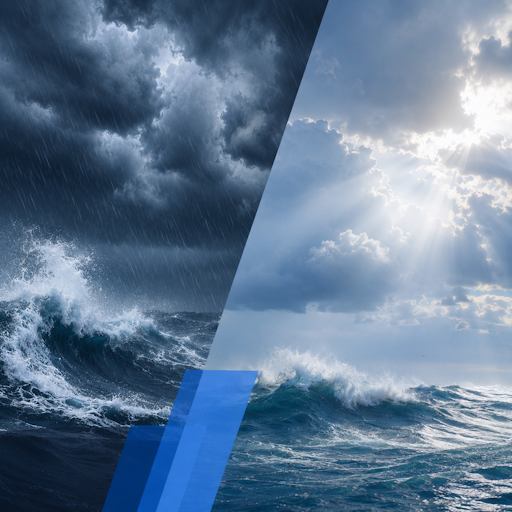
A strong cold front pushes through NSW coastal waters on Friday June 5, closing bars and building offshore swell to 2.5 metres.
A high pressure system follows Saturday into Sunday, turning winds to the south-east and opening a recovery window for the weekend.
What to watch
Track the high's timing - if it stalls, Sunday will fish well; if it accelerates, expect another frontal trough early next week.
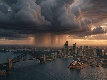
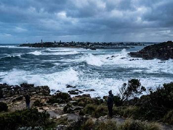
NSW coastal bar users are facing a forced pause this Thursday and Friday as a deep, complex low pressure system near Tasmania drives a vigorous cold front across the state's coastal waters.
The Bureau of Meteorology issued a Strong Wind Warning for Sydney Coastal Waters late Wednesday, with westerly winds of 15 to 20 knots forecast to reach up to 30 knots offshore.
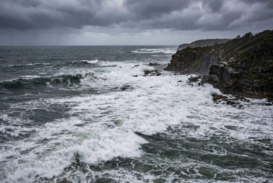
Offshore swell builds to 1.5 to 2.5 metres from Friday, against a base of around one metre inshore - conditions that render most coastal bars hazardous or uncrossable.
According to the Bureau of Meteorology's coastal waters forecast, issued 10:00 pm EST Wednesday 3 June 2026, a vigorous south to south-westerly flow develops from Friday as the cold front and associated trough cross the coastal waters.
The synoptic driver
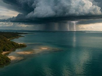
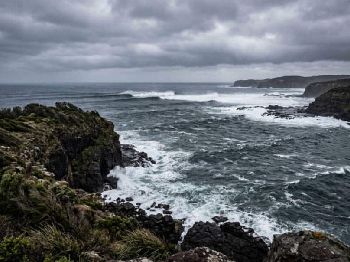
A deep, complex low has been tracking from the Southern Ocean, crossing Tasmania before pushing into the Tasman Sea - the classic winter frontal track that brings the Australian east coast's heaviest marine conditions.
This kind of system develops along the Southern Ocean's baroclinic zone, where a sharp contrast between polar air masses and the warmer subtropical ridge generates intense pressure gradients and rapid wind development over Bass Strait and the Tasman.
The low is currently at its most energetic stage - its interaction with Tasmania's terrain forces further deepening before it exits into the Tasman Sea, dragging the cold front north across NSW.
The front carries classic post-frontal signatures: an abrupt wind shift from north-westerly ahead of the trough to south to south-westerly behind it, with associated swell building from the south-west in the two to three days following passage.
"Vigorous south to south-westerly flow is forecast from Friday as a strong cold front and trough cross the coastal waters." - Bureau of Meteorology, Sydney Coastal Waters Forecast, 3 June 2026
Bar conditions Thursday to Friday
The hazardous window for bar crossings on the NSW coast runs from late Thursday afternoon through Friday, aligning with peak north-westerly winds ahead of the front and the swell response that follows.
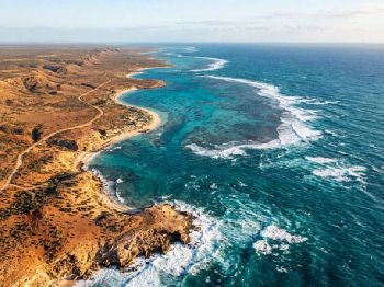
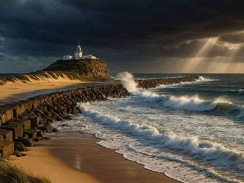
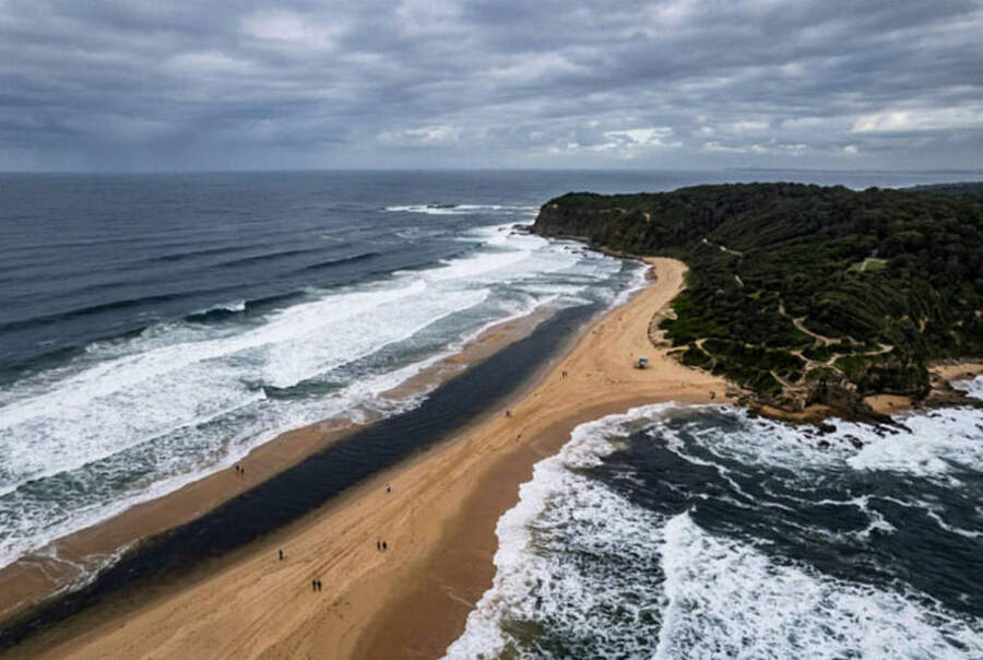
NSW coastal bars at Swansea, Merimbula, Narooma, Ulladulla, and Eden all carry elevated risk when swell exceeds 1.5 metres because wave energy is refracted and concentrated at the shallow shoaling ground just seaward of the entrance channels.
Breaking waves at bar mouths during frontal conditions can be deceptively irregular - the residual north-east background swell sets can cross with incoming south-west energy to produce confused, square seas in the channel.
Marine Rescue NSW advises that wind gusts at the bar can run 40 per cent stronger than the marine forecast figures, and maximum waves can reach twice the forecast height in squalls.
The practical test is simple: if you can see white water across the bar mouth from shore, it is closed.
What offshore means for fishers and divers
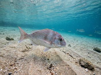
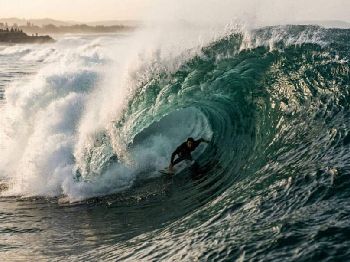
Offshore pelagic fishing shuts down effectively Thursday through Friday, with 2.5-metre-plus seas making working a drift impossible and ground lines on shallow reefs unfishable in the surge.
Dive charters operating off Sydney, Wollongong, and the South Coast will pull trips on Friday - 2-metre-plus swell on south-facing reef systems creates zero-visibility silt-out conditions and hazardous surface recoveries.
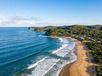
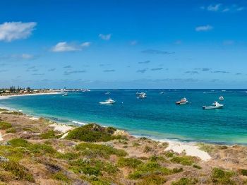
The useful targeting window sits inside the estuaries and lagoons: Sydney Harbour, Pittwater, Jervis Bay, Batemans Bay, and Lake Macquarie all sit behind protective headlands that block the south-west swell sector entirely.
Wind-on-water inside estuaries will still build chop from the north-west on Thursday, so set anchors carefully and face your vessel into the prevailing wind if fishing shallow sandflats.
The recovery window
A high pressure system is forecast to strengthen over the coastal waters Saturday into Sunday, turning winds south-east to north-easterly and marking the front's passage as complete.
Post-frontal conditions on Saturday morning will still carry 1.5 to 2-metre residual swell from the south-west - the sea state left behind after the front's winds have eased, often called a groundswell tail.
This is significant for bar crossings: even with eased winds Saturday morning, swell period will be long (10 to 14 seconds typically) and the bars will need to be checked in person before any crossing attempt.
By Sunday, swell is expected to moderate to under 1.5 metres in most areas, and the north-easterly sea breeze pattern will begin to re-establish - a reliable signal for day-trip conditions on the south coast.
The post-frontal southerly swing also sets up productive surface fishing for tailor and salmon running ahead of the cold water push, as baitfish compress against the temperature boundary.
Non-obvious pattern note
This front is the second in a series of active frontal passages through south-east Australia in the past 10 days, following the deep Tasman low that brought closures mid-week.
Sequential fronts at this frequency - roughly every four to five days, are characteristic of a strongly negative Southern Annular Mode phase, where the polar jet sits abnormally far north and drives frontal activity directly up the Tasman.
Practically speaking, that means the pattern from late May through mid-June 2026 has produced more closed-bar days along the NSW south coast than a typical June, and the windows between events are shorter.
Offshore runs in the next three weeks are best planned for the 48 hours following each front's passage - the days when the high is overhead and the residual swell is still building the chum lines that bring pelagic fish to the surface.
Planning your session
Thursday afternoon to Friday - avoid all coastal bars and exposed headland platforms; strong north-westerly gusts to 30 knots offshore, building swell.
Friday evening - front crosses; south to south-westerly shift with sustained 20-knot gusts and 2 to 2.5-metre southerly swell establishing overnight.
Saturday - residual swell still 1.5 to 2 metres; bars need visual inspection; enclosed harbours and estuary mouths reasonable if winds have eased to under 15 knots.
Sunday - best day of the weekend; swell easing toward 1 to 1.5 metres, high pressure stable, bars accessible at most NSW south coast ports by late morning.
Common questions
Can I cross the bar at dawn on Saturday? At most NSW south coast bars, no - residual swell from a 30-knot overnight frontal passage takes 12 to 18 hours to settle.
Is Sydney Harbour fishable on Friday? Yes, but north-westerlies funnelling through the heads will create steep chop on the lower harbour.
The enclosed upper reaches, including the Parramatta River, Lane Cove, and Middle Harbour, are sheltered enough for light gear.
Will the rock ledges be safe Saturday? Check swell height and direction before committing to any ledge.
South-west swells of 1.5 metres wash all low-lying south and south-east facing ledges on the NSW coast, even with light winds in post-frontal conditions.
Where should I fish Friday if everything is closed? Target Lake Illawarra, Tuggerah Lakes, or Wallis Lake for bass and bream in sheltered water.
Work the harbour at Wollongong or Lake Macquarie for luderick on the seawall - the north-westerly wash pushes bait into the sea walls and activates feeding through the tide change.
Track the latest marine warnings and check the bar camera feeds at your local estuary before launching. The Seabreeze NSW marine warnings page updates in real time as BOM revises its forecasts through Thursday and Friday.